What Compass Is
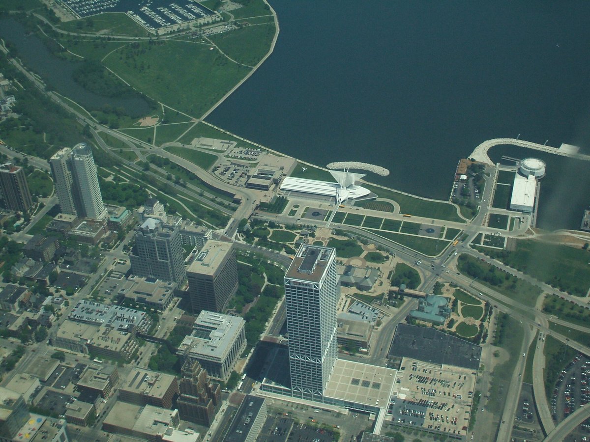
Milwaukee, Wisconsin, sits on the western shore of Lake Michigan. Its history, cultural diversity, and modern development are reflected in its neighborhoods, festivals, public art, and visitor resources. “Compass” in Milwaukee refers both to the Compass Milwaukee Digital Visitors Map, a tool for exploring the city, and to Jon Barlow Hudson’s public sculpture above the Brady Street Pedestrian Bridge.
The Milwaukee Digital Visitors Map helps visitors find attractions, local businesses, neighborhoods, and events. The sculpture, installed in 2005, is a free, accessible landmark that connects navigation, local geology, and public art.
History
Long before European arrival, the Milwaukee region was home to the Potawatomi, Menominee, and Ho-Chunk (Winnebago) peoples. The area’s name is derived from the Algonquian “Millioke,” meaning “good land” or “gathering place by the water.” Its rivers and Lake Michigan provided resources and trade routes, making the region an important Indigenous hub (The Broke Backpacker).
French missionaries and fur traders arrived in the late 17th century, followed by American settlers in the early 19th century. Rival settlements—Juneautown, Kilbourntown, and Walker’s Point—were united in 1846 to create the City of Milwaukee, after competition and a brief “Bridge War” (GPSmyCity).
Immigration shaped the city through the 19th century. Germans, Poles, Irish, Italians, and others settled in Milwaukee; by 1850, Germans made up almost a third of the population. Their influence remains visible in the city’s culture, architecture, and beer tradition (Visit Milwaukee). Milwaukee’s lakefront and river network supported manufacturing and brewing. By 1890, the city led the world in beer production, earning the nickname “Brew City” (The Planet D).
The growth of the city brought landmarks including Milwaukee City Hall (1895), once the world’s tallest habitable building, and the Pabst Theater (1895), one of the oldest continuously operating theaters (GPSmyCity). The Historic Third Ward, once an industrial district, was rebuilt after an 1892 fire and is now an arts and culture hub with preserved 19th-century architecture (The Broke Backpacker).
Milwaukee became known for “Sewer Socialism,” a pragmatic socialist movement associated with public health, sanitation, and municipal reform. The city had three socialist mayors between 1910 and 1960 (Visit Milwaukee). African American migration and immigration from Latin America and Asia further enriched its neighborhoods. The city celebrates its diversity through festivals and community organizations (Lineup2025).
As manufacturing declined in the late 20th century, Milwaukee diversified into healthcare, education, and technology. Urban renewal transformed downtown and riverfront industrial sites into parks, museums, and entertainment spaces (Visit Milwaukee).
The city also supports community health initiatives. Health Compass Milwaukee has provided up-to-date demographic and health data through a collaborative platform since 2019 (MHCP). The 2024 Community Health Needs Assessment incorporates input from residents and stakeholders to guide public health planning and cross-sector solutions (MHCP).
What to See
The Compass Sculpture
The Compass sculpture stands above the Brady Street Pedestrian Bridge in Milwaukee, Wisconsin. It is made of four Wisconsin granite blocks placed at the cardinal points and linked by polished steel tubes that form a circle. The stones—Wausau Ruby Red, Glacial Rose, Amberg Silver Grey, and Mellen Black Gabbro—represent Wisconsin geology. The mirrored steel invites reflection on community and orientation within the city.
Interpretive signage explains the sculpture’s geology and symbolism. Educators and guides also use it to discuss Milwaukee’s navigation history and public art.
Milwaukee Attractions and Cultural Life
Milwaukee’s festivals include Summerfest and ethnic celebrations reflecting the city’s German, Polish, Irish, Italian, African American, and Latinx heritage (Lineup2025). The Milwaukee Art Museum and Harley-Davidson Museum highlight the city’s creative and industrial history (Visit Milwaukee).
Other attractions include the Milwaukee Public Museum, Pabst Mansion, Milwaukee Public Market, Mitchell Park Domes, and Veterans Park. The Historic Third Ward is known for art galleries and its public market, while the Milwaukee Riverwalk and its historic warehouses offer photo spots.
Neighborhoods
- Historic Third Ward Arts, culture, dining, galleries, and the public market.
- East Town Nightlife, museums, festivals, and lakefront areas.
- Westown Museums and green spaces.
- Brewer’s Hill River views and brewing history.
- Lower East Side Galleries, parks, and local businesses.
- Bay View Vintage shops and dining.
- Walker’s Point Nightlife and cultural diversity.
- Riverwest A neighborhood highlighted by the digital visitors map.
Milwaukee’s festivals, neighborhoods, and community health efforts reflect its cultural variety and commitment to equity (MHCP).
Compass Milwaukee Digital Visitors Map
The Compass Milwaukee Digital Visitors Map is a digital navigation and visitor-engagement tool for exploring neighborhoods and cultural landmarks. It highlights Milwaukee’s history as a crossroads of commerce and culture, shaped by German, Polish, African American, Latinx, and other communities (nomadsunveiled.com).
Features include:
- Free, real-time maps and guides.
- Neighborhood highlights, including the Third Ward, Bay View, Riverwest, and Walker’s Point (Tourist Secrets).
- Curated guides by interest, such as dining, arts, family activities, and nightlife (visitmilwaukee.org).
- An interactive map that can be filtered by category, proximity, or event.
- Favorites and custom itinerary lists.
- Event information for festivals and seasonal activities.
- Details about safe routes, transportation, accessibility, and family-friendly options (travellikeaboss.org; mkewithkids.com).
- A mobile-friendly format that can be added to iOS or Android home screens.
Practical Visiting Information
Hours, Tickets, and Tours
Milwaukee City Hall
- Hours: Monday–Friday, 8:00 AM–5:00 PM.
- Admission: Free.
- Guided tours: By appointment.
- Accessibility: Wheelchair accessible.
- Nearby: Cathedral of St. John the Evangelist and Milwaukee Public Museum.
Pabst Theater
- Box office: Monday–Saturday, 10:00 AM–6:00 PM.
- Event times vary.
- Tickets: Online or at the box office; prices vary by event.
- Accessibility: Accessible seating; contact the box office.
- Tours: Seasonal; check the website for details.
Historic Third Ward
- Open year-round.
- Guided and self-guided tours are available.
Milwaukee Art Museum
- Hours: Tuesday–Sunday, 10:00 AM–5:00 PM; Thursdays until 8:00 PM.
- Admission: Adults $19; seniors and students $17; children under 12 free.
- Accessibility: Fully accessible.
Harley-Davidson Museum
- Hours: Daily, 10:00 AM–5:00 PM.
- Admission: Adults $22; seniors and military $19; youth ages 6–17 $12.
- Guided tours are available; reservations are recommended.
Milwaukee Public Museum
- Hours: Daily, 9 AM–5 PM.
- Admission: Adults $19; seniors $17.
Pabst Mansion
- Tours: Wednesday–Sunday.
- Admission: Approximately $15.
Sculpture Access and Transport
- Hours and admission Open 24/7; free.
- Accessibility Wheelchair accessible via paved paths and ramps.
- Bike Located on a major bike path linking the East Side to Downtown.
- On foot Walk from Brady Street or nearby areas.
- Car Parking is available near Brady Street, followed by a short walk to the bridge.
- Transit Milwaukee County Transit System buses run nearby.
Getting Around and Planning
Milwaukee’s transportation options include MCTS buses, The Hop streetcar, bike lanes, the Oak Leaf Trail, and rideshares. The downtown street grid can be navigated by compass or GPS. General Mitchell International Airport serves as the city’s airport.
The Milwaukee Digital Visitors Map is free to use, though some attractions require admission (Budget Your Trip). Allow 1–2 days for highlights and longer for deeper exploration. Visitor support is available at the Official Visitor Center at 648 N Plankinton Ave, Ste 220.
Most attractions have accessibility features, but details vary by site. MCTS buses accommodate disabilities, and the digital map includes accessibility information for some listings, including wheelchair and sensory-friendly accommodations. Check site details and barrier-free routes in advance.
Tips
- Add the Digital Visitors Map to your phone and use “Browse Guides” to find themed itineraries.
- Check event, safety, and seasonal information on the map. Its listings are regularly refreshed with event details.
- Use public transit, The Hop streetcar, bike rentals, or rideshares; the map includes route and transportation information (travellikeaboss.org).
- Stick to well-lit, popular areas and follow local regulations on alcohol and smoking.
- Milwaukee has warm summers and cold winters; plan clothing accordingly. During festivals, use a map or compass to choose meeting points.
- Purchase tickets online in advance for popular venues and check seasonal hours, especially during festivals.
- Wear comfortable shoes for walking tours and biking. Sunrise and sunset offer good light for visiting and photographing the Compass sculpture.
- Bring a camera; the sculpture is open to photography.
- For Milwaukee’s Art Museum wings, the Milwaukee Riverwalk, and Historic Third Ward facades, virtual tours are available on many official sites. Images and online virtual tours can also be previewed when planning a route.
- Consider Milwaukee CityPASS® for attraction discounts.
- Sample local cuisine at the Milwaukee Public Market and neighborhood delis. Milwaukeeans are welcoming; visitors can join festivals while respecting local customs.
Nearby Places
Near the Compass sculpture, Brady Street has cafes, boutiques, and nightlife. The Milwaukee Art Museum is a short bike ride away, and the Historic Third Ward offers culture and dining. Some local walking and biking tours include the sculpture; check tour operators’ schedules.
The Milwaukee Riverwalk and historic warehouses are nearby photo spots. Milwaukee City Hall is near the Cathedral of St. John the Evangelist and Milwaukee Public Museum.
FAQ
What are the Compass sculpture’s hours?
It is accessible 24/7 and admission is free.
Is the Compass sculpture wheelchair accessible?
Yes. Paved paths and ramps provide access.
Can I take photos of the sculpture?
Yes.
Are there tours that include Compass?
Some walking and biking tours include it; check with tour operators.
What are Milwaukee City Hall’s hours?
Monday–Friday, 8:00 AM–5:00 PM. Tours are by appointment.
How do I buy Pabst Theater tickets?
Online or at the box office.
Are Milwaukee’s historical sites accessible?
Most sites, including City Hall and the Art Museum, are wheelchair accessible. Check each site for details.
Which historical sites should I see?
City Hall, the Pabst Theater, Historic Third Ward, Milwaukee Art Museum, and Harley-Davidson Museum are among the sites highlighted. Other visitor-guide recommendations include the Milwaukee Public Museum and Pabst Mansion.
When is the best time for festivals?
Summer, especially during Summerfest.
Are Historic Third Ward tours available?
Yes. Guided and self-guided tours are available year-round.
What are the visiting hours for historical sites?
A general guide lists most sites as open 10 AM–5 PM; check the Compass map for specific hours.
Is Compass Milwaukee free?
Yes. The digital map is free, although some attractions require tickets.
Can I use Compass Milwaukee on a phone?
Yes. It is web-based and can be added to a phone’s home screen.
Does the map provide accessibility information?
Many listings note wheelchair and sensory-friendly accommodations.
What language options does Compass Milwaukee offer?
It is primarily in English; its intuitive design aids usability.
How can I stay updated on events?
Compass is regularly refreshed with event information.
Where can I check attraction hours and ticket prices?
Check official attraction websites or Discover Milwaukee.
How can I navigate Milwaukee festivals?
Use maps, a compass, and mobile apps.
Is Milwaukee transit accessible?
Yes. MCTS buses accommodate disabilities.
Are guided tours available at Milwaukee attractions?
Many sites offer tours; check schedules online.