
What Many Parks Curve Is
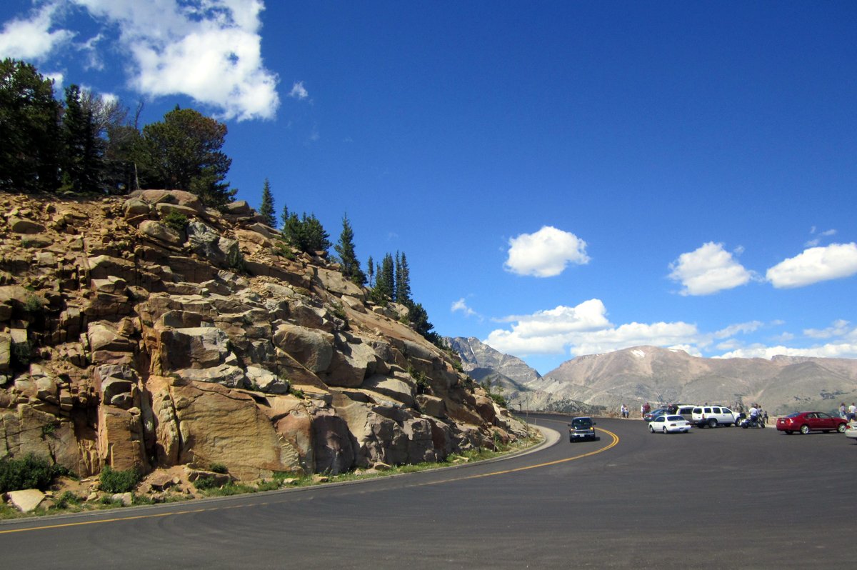
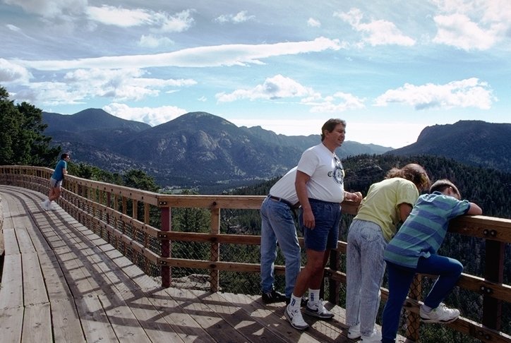
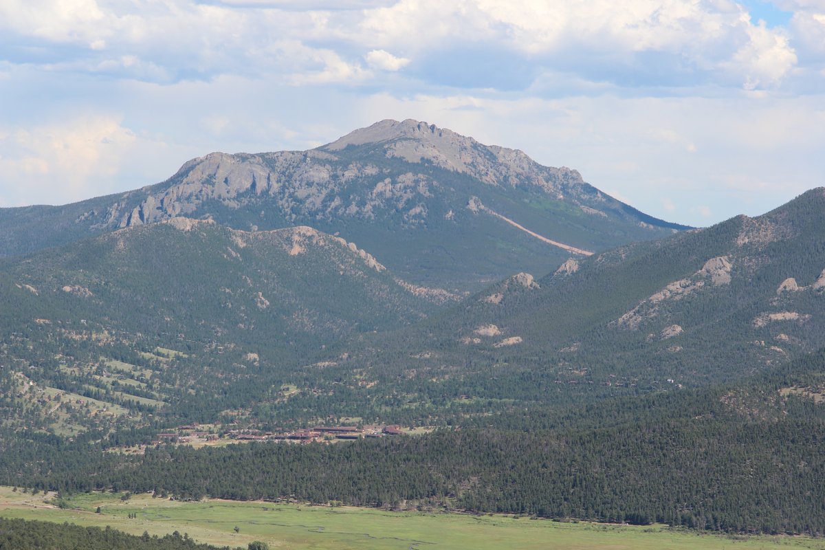
Many Parks Curve Overlook is a scenic viewpoint on Trail Ridge Road in Rocky Mountain National Park, just west of Estes Park, Colorado. It is one of the first major overlooks west of Estes Park and offers sweeping views of glacially carved valleys, locally known as “parks,” including Moraine Park, Horseshoe Park, and Beaver Meadows. From the overlook, visitors can also see Longs Peak and the Mummy Range (Triptins).
The overlook is at approximately 9,620 feet—also given as 9,620 feet—and provides a vantage point for observing the region’s alpine landscapes, ecosystems, and cultural history. It marks a transition from subalpine forest to alpine tundra, and is also described as an important transition between montane and subalpine ecosystems (Lost With Lydia).
History
Indigenous Presence and Settlement
People have inhabited the area for at least 12,000 years. The Ute and Arapaho established seasonal migration routes through the valleys.
Early explorers such as Major Stephen H. Long and settlers such as Joel Estes contributed to the growth of the Estes Park community and the development of modern tourism.
Rocky Mountain National Park and Trail Ridge Road
Rocky Mountain National Park was established in 1915, largely through the advocacy of conservationists such as Enos Mills. Many Parks Curve’s inclusion within the park boundaries helped preserve the site.
Trail Ridge Road was completed in 1932. It is the highest continuous paved road in North America and was engineered to showcase the park’s varied landscapes, with Many Parks Curve as a scenic stop (AllEstesPark).
Today, the National Park Service maintains the overlook with interpretive signage, educational programs, and conservation initiatives. Collaboration with Indigenous communities and historians also informs interpretation at the site.
What to See
Views, Geology, and Landscape
Many Parks Curve looks out over Moraine Park, Horseshoe Park, Beaver Meadows, Longs Peak, and the Mummy Range. Interpretive signs help explain the landscape.
The region’s granite and gneiss date back more than 1.4 billion years. Tectonic uplift during the Laramide Orogeny formed the peaks and ridges visible today (5280 Magazine).
During the Pleistocene Epoch, glaciers carved the broad U-shaped valleys visible from the overlook. The Alluvial Fan is an example of ongoing geological processes (Intrepid Scout).
At 9,620 feet, the overlook is at the ecological tree line, above which trees cannot survive (That Colorado Couple).
Plants, Wildlife, and Wetlands
Below the tree line, the area supports Engelmann spruce, subalpine fir, and lodgepole pine; above it, hardy tundra plants grow. Wildlife in the area includes elk, mule deer, black bears, pikas, and marmots (Estes Park, Full Suitcase). Elk, mule deer, moose, bighorn sheep, and various birds may also be seen, especially in adjacent meadows.
Nearby wetlands fed by the Big Thompson River support amphibians, waterfowl, and the greenback cutthroat trout (Intrepid Scout).
Seasonal Changes and Photography
Wildflowers typically reach peak bloom in June–July. Late September is prime time for fall colors and golden aspens. Afternoon thunderstorms are common in summer, and snow is possible in spring and fall.
The overlook is a photography spot for panoramic views of the valleys and Longs Peak. Sunrise and sunset provide dramatic light; a tripod can help in low-light conditions. Ranger-led programs and educational tours often include Many Parks Curve, particularly in summer. Seasonal tours and events are listed on the NPS schedule and NPS events calendar.
Practical Visiting Information
Hours, Access, and Tickets
Many Parks Curve is typically accessible from late May through mid-October, when Trail Ridge Road is open. The overlook is open during daylight hours.
All visitors must pay the standard Rocky Mountain National Park entrance fee; there is no additional charge for Many Parks Curve. During peak months, from late May to mid-October, a timed-entry permit is required for vehicles entering the park and accessing Trail Ridge Road. Permits and park passes can be obtained online in advance, and timed-entry permits often sell out. See the NPS Timed Entry Permit System and NPS Timed Entry.
Location and Transportation
The overlook is on Trail Ridge Road (U.S. Highway 34), about 7–9 miles west of Estes Park via the Beaver Meadows Entrance (roadtravelamerica.com). It is accessible by car. Estes Park shuttles do not reach the overlook, and there is no direct shuttle service.
Check road conditions and status before visiting. Cell service is unreliable.
Accessibility and Facilities
A paved path connects the parking area to the observation deck and is suitable for wheelchairs, strollers, and mobility aids. The grade is generally gentle, though there are some mild inclines.
Parking is limited and fills quickly during peak hours, from 10:00 a.m. to 3:00 p.m. There are no restrooms at the overlook; the nearest facilities are at Beaver Meadows and Alpine Visitor Centers.
Pets are not allowed at overlooks or on trails. In an emergency, dial 911; rangers patrol the area.
Further Information
- Rocky Mountain National Park Official Website
- Estes Park Visitor Center
- Trail Ridge Road Status Updates
- Lost With Lydia: Rocky Mountain National Park Itinerary
- AllEstesPark: Best Time to Visit the Rockies
- NPS Timed Entry Permit System
- 5280 Magazine
- Intrepid Scout: Best Stops on Trail Ridge Road
- That Colorado Couple: Trail Ridge Road
- Estes Park
- Full Suitcase: Rocky Mountain National Park Itinerary
- Earth Trekkers: Rocky Mountain National Park Itinerary
- Triptins: Trail Ridge Road
- chasingadvntr.com: Estes Park Things To Do
- roadtravelamerica.com: Estes Park Colorado Travel
- visitestespark.com: Visitor Guide
Tips for Visiting
- Arrive early for parking, or visit in the early morning or late afternoon for better light and fewer crowds. Sunrise and sunset are also recommended for wildlife viewing.
- Dress in layers because high-elevation weather changes rapidly; prepare for high UV exposure as well.
- Bring water, snacks, a camera, and a park map. Hydrate and allow time to acclimate to the elevation.
- Follow wildlife-viewing rules and safety guidelines, stay on trails, observe wildlife from a distance, and follow Leave No Trace practices.
- The National Park Service manages access to protect sensitive alpine environments; avoid peak times when possible.
For audio tours, interactive maps, and insider tips, the Audiala mobile app is available. Audiala also recommends following its social media and consulting the app for current road and weather conditions.
Nearby Places
- Rainbow Curve A scenic stop noted for frequent rainbows and dramatic weather.
- Forest Canyon Overlook
- Alpine Visitor Center The highest visitor center in the park, with exhibits and a café; it is also described as the highest point on Trail Ridge Road.
- Estes Park town
- Estes Park Museum Explores local history and Indigenous cultures.
- Stanley Hotel A historic hotel known for its architecture and literary connection.
- Moraine Park Discovery Center Features exhibits on geology and wildlife.
These stops offer additional scenic, historical, and cultural context for a visit to Many Parks Curve (chasingadvntr.com).
Frequently Asked Questions (FAQ)
Do I need a ticket to visit Many Parks Curve?
The standard Rocky Mountain National Park entrance fee applies. During peak season, a timed-entry permit is also required.
What are the best times to visit?
Early morning and late afternoon are recommended for better light, wildlife viewing, and fewer crowds.
Is Many Parks Curve accessible for people with disabilities?
Yes. A paved path leads from the parking area to the overlook.
Are guided tours available?
Ranger-led and educational tours are available seasonally. Check the NPS schedule.
What wildlife might I see?
Wildlife includes elk, mule deer, moose, bighorn sheep, and various birds, especially in adjacent meadows.