Hoover Dam Was One of the Most Deadly Projects in History
Saffron
13 min
601K
Clark CountyUnited States 36° N · 114° W Updated May 2026
Hoover Dam holds back 6.6M tons of concrete and Lake Mead — which still supplies nearly 90% of Southern Nevada's drinking water.
 Photo: Carlin Harris / Pexels
How do you make a desert river disappear, then turn its silence into electricity for millions? Hoover Dam in Clark County, United States, is worth the detour because it lets you stand inside that answer: a 726-foot wall of concrete in Black Canyon, where the Colorado River was forced into obedience and the modern American Southwest was built from the bargain.
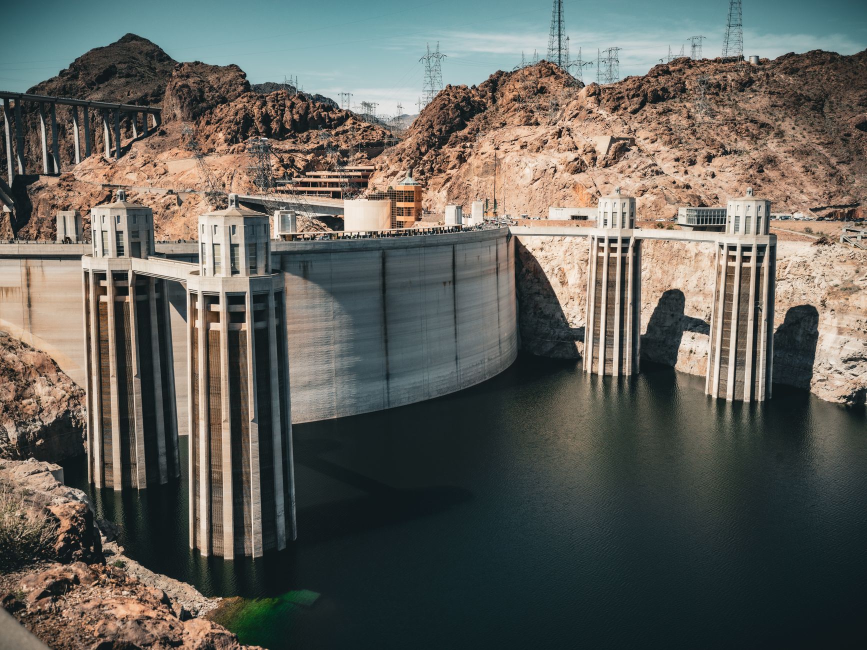
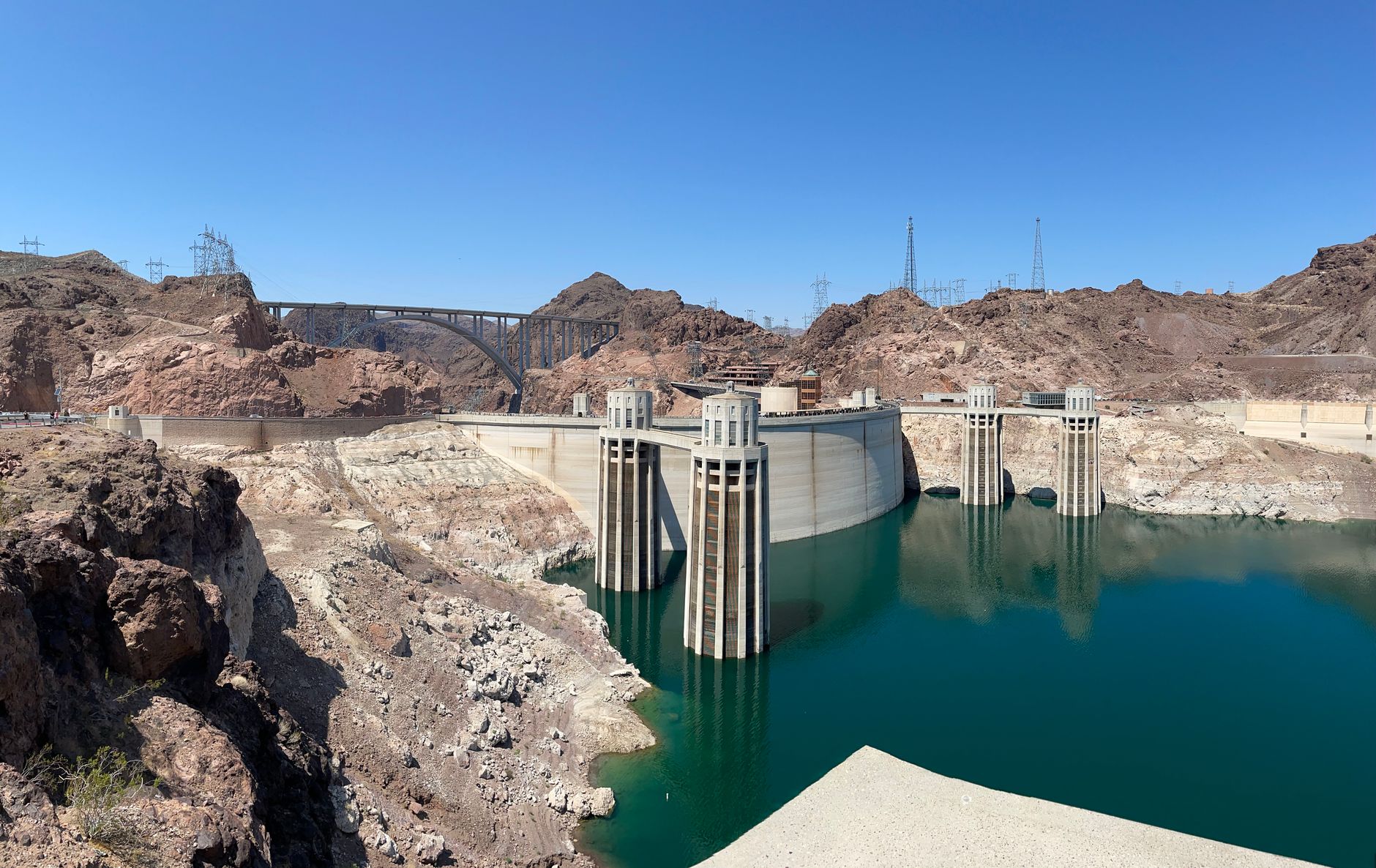
What you see now is oddly theatrical. Lake Mead spreads behind the dam like a sheet of dull blue metal, the intake towers rise from the water with the cool confidence of Art Deco chess pieces, and the generator halls hum below your feet while the desert light bounces hard off pale concrete.
The scale lands slowly. Records show the dam contains 3.25 million cubic yards of concrete, enough to pour a highway from San Francisco to New York if you believed the old publicity line, yet the more memorable fact is this: engineers had to lace the structure with nearly 600 miles of cooling pipe because the mass would have taken about 125 years to cool on its own.
Most visitors come for the viewpoint and the improbable setting, and fair enough. But the real reason to visit is sharper than scenery: Hoover Dam is where politics, labor, vanity, fear of floods, and a near-religious faith in engineering were all poured into one hard American object.
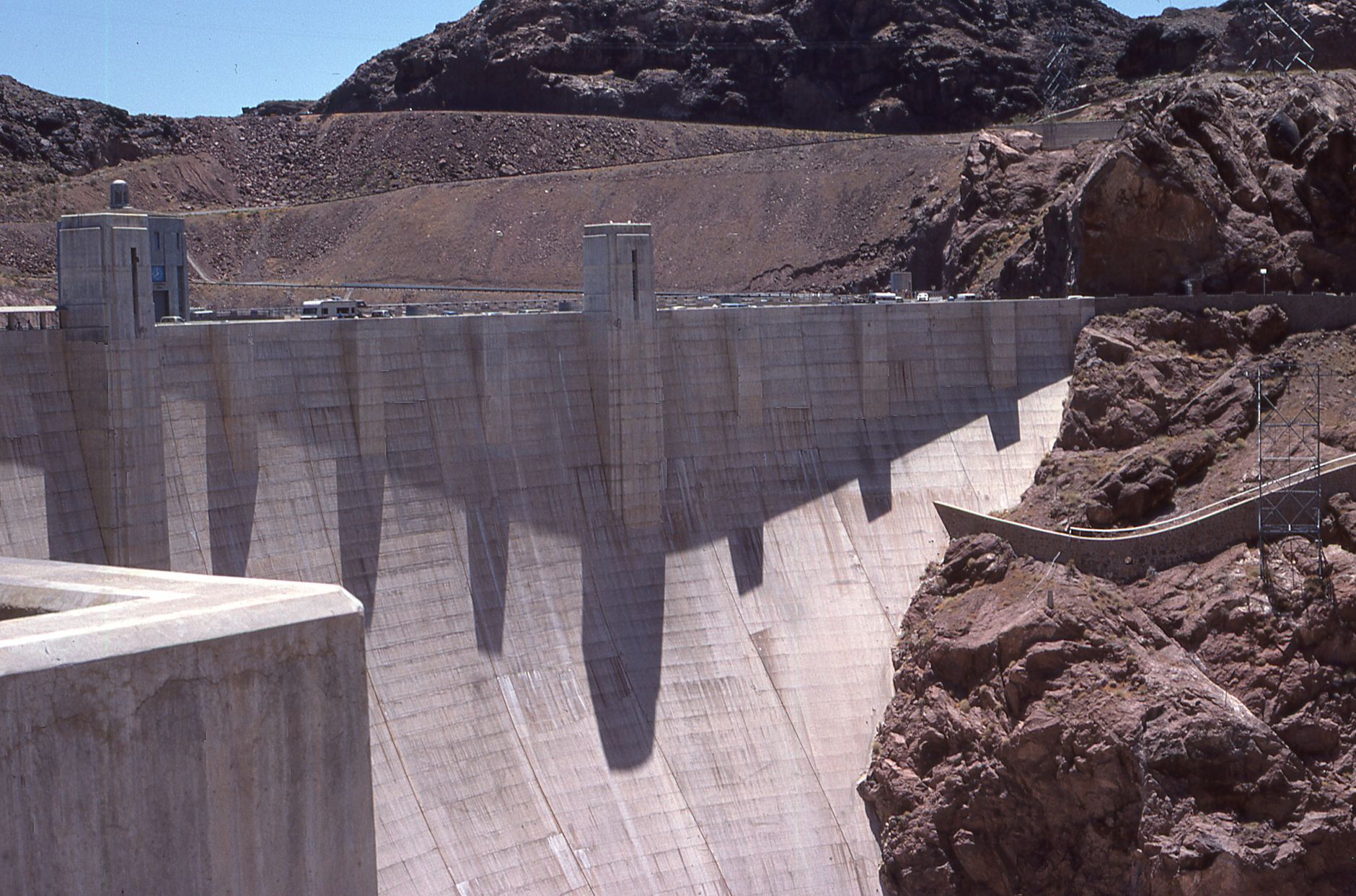
Walk the crest first. One side drops 726 feet to the Colorado, the powerplant, and the bridge; the other opens onto Lake Mead and the four intake towers standing in water like Art Deco rockets. Wind funnels through Black Canyon and the concrete throws back a hard, pale glare — bring sunglasses and a hat, because Gordon Kaufmann designed for legibility, not shade.
Then find the floor. At Oskar Hansen's Winged Figures of the Republic, two 30-foot bronzes rise from polished black diorite plinths beside a 142-foot flagpole. Most visitors photograph the wings and walk on. Look down instead — the terrazzo star map fixes the sky exactly as it appeared on September 30, 1935, the day FDR dedicated the dam, encoded so future astronomers could read the date from the stones.
The elevator towers reward the same downward-then-upward attention. Bas-reliefs on the Nevada side narrate flood control, irrigation, navigation, water storage, and power; the Arizona tower carries Indigenous faces of the Colorado basin. Kaufmann's restraint is the trick — plain concrete masses, then ornament concentrated in three or four moments you have to stop and find.
The $30 dam tour is the part that rearranges your sense of the place. You ride an original 1930s elevator down through the structure, walk historic construction tunnels, and end at a platform above a 30-foot-diameter penstock where water rushing toward the turbines makes the steel — and your shoes — physically vibrate. It is the closest thing to touching the river without getting wet.
The strangest moment comes in the inspection tunnels. Mass concrete presses in on every side, footsteps go flat and short, the air cools maybe ten degrees from the crest above. Then a guide stops you at a ventilation shaft and points down. A clean vertical slot frames the Colorado far below, the canyon walls cropped to a single rectangle of moving green water.
The shorter Power Plant Tour ($15) skips the inspection tunnels but keeps the best machine view: eight generators lined up in the Nevada wing of the powerhouse, terrazzo floors banded with brass and aluminum in patterns Allen True drew from Pueblo and Navajo geometries. Look down here too. Most people don't.
For the full frontal portrait of the dam, you have to leave it. The pedestrian walkway on the Mike O'Callaghan–Pat Tillman Memorial Bridge, 890 feet above the river, gives you the only angle where dam, powerplant, intake towers, and Black Canyon stack into a single legible composition. Cars can't stop here; phones can. Go in late afternoon when the western canyon wall throws long shadow across the concrete face.
Then take the Historic Railroad Trail from the parking area near the visitor center. It follows the original construction railbed through five long tunnels blasted for the trains that hauled Six Companies' supplies, with a "bone yard" of concrete plugs and rusted hardware near the dam end. Skip it in summer — the first 1.5 miles have zero shade and NPS specifically warns the surface gets dangerous. Winter, spring, and fall, it's the quiet half of the visit.



History
Hoover Dam did not rise from empty desert ambition. Records show it came after decades of Colorado River chaos: failed irrigation schemes, the 1905-1907 breach that helped create the Salton Sea, and a growing fear that the river could wreck farms one year and leave cities thirsty the next.
The official story celebrates triumph, and the triumph is real. But the closer you look, the more the dam becomes a fight over names, credit, bodies, and who got written into the monument once the concrete set.
The turning point
At first glance, the story seems simple: Herbert Hoover helped broker the Colorado River Compact in 1922, the federal government built a giant dam, and the nation named it for the man who made the deal possible. That is the version most visitors accept when they read the plaque and move on.
But the timeline catches. Secretary of the Interior Ray Lyman Wilbur publicly called it Hoover Dam on 17 September 1930, then Harold Ickes, serving Franklin D. Roosevelt, pushed the name back to Boulder Dam in 1933 as Hoover became politically toxic during the Depression. For Hoover, this was personal as well as political; a project tied to his reputation for efficiency had turned into a public reminder of national misery.
The turning point came on 30 April 1947, when President Harry S. Truman signed the resolution restoring the name Hoover Dam. Records show the surface story survived because the structure was too useful to abandon and too symbolic to leave unnamed, so each administration tried to claim its meaning while pretending the concrete itself was neutral.
Knowing that changes the view. When you look up at the dam now, you are not just seeing engineering on a heroic scale; you are seeing a national argument frozen in place, with Herbert Hoover's bruised legacy still clinging to the canyon walls.
Yes, especially if you go beyond the photo stop on the bridge. The contrast between the blinding open crest, the cool tunnel interiors, and the Art Deco terrazzo floors underfoot is what people remember; rushing the bridge view alone misses the best part. Pair it with lunch in Boulder City and it becomes a full day rather than a tick-box detour.
Plan about 2 hours on site for the Power Plant Tour plus exterior, or 2 to 2.5 hours if you want the full Guided Dam Tour with the inspection tunnels and ventilation shaft. From Las Vegas as a half-day outing, budget 4 to 6 hours including the security checkpoint, parking, and the bridge overlook. A pure photo stop on the crest works in 45 minutes to an hour.
Drive I-11 S / US-93 S to Exit 2, take the third exit at the traffic circle onto NV-172 (Hoover Dam Access Road), and continue to the site about 30 miles southeast of the Strip. There is no direct public bus, so without a car the practical option is a guided hotel-pickup tour rather than transit. Rideshare runs roughly $60 to $80 one way, but the return ride is harder to secure because the site is remote.
Winter and spring, hands down. Summer highs at Lake Mead average 89 to 103°F and the open concrete plaza becomes punishing; April through June stays in the 80s to high 90s and is much easier for walking. Arrive before 9:00 a.m. year-round if you want the full Guided Dam Tour, since it sells out and is on-site only, first come first served.
Yes, the exterior is free. Walking the crest, photographing the Winged Figures of the Republic, and crossing the Mike O'Callaghan-Pat Tillman Memorial Bridge cost nothing beyond the $10 parking fee in the Nevada-side garage. Interior access costs $15 for the self-guided Visitor Center, $25 for the Power Plant Tour, or $40 for the Guided Dam Tour, and America the Beautiful passes are not accepted.
The terrazzo star map at Monument Plaza, which fixes the night sky at the moment FDR dedicated the dam on September 30, 1935. Most people photograph Oskar Hansen's bronze Winged Figures and walk straight over the floor without looking down. Also seek out the bas-reliefs on the elevator towers and, if you take the Guided Dam Tour, the ventilation shaft view straight down to the Colorado River.
Yes. The Guided Dam Tour ($40, on-site booking only) takes you through original construction tunnels, the powerplant, an inspection tunnel inside the concrete, and the ventilation shaft view. The shorter Power Plant Tour ($25 adult, $15 ages 4-16) covers the construction tunnels and a platform above a 30-foot penstock where you can feel the water vibration through the floor.
Drive 8 minutes back to Boulder City rather than relying on on-site concessions. Locals push visitors to Coffee Cup Cafe for breakfast, Fox Smokehouse BBQ or Boulder Dam Brewing Company for lunch, and Restaurant 1933 inside the historic Boulder Dam Hotel at 1305 Arizona Street for something more polished. The Bighorn Cafe at Hoover Dam Lodge on Highway 93 runs 6 a.m. to 10 p.m. daily if you need something closer.
Built from cited sources · see the method · How we make our guides →
Saved and recently read places — kept on this device only.
Photos may have been resized or cropped.