Pierre À Mille Trous
BursinsSwitzerland 46° N · 6° E Updated Aug 2026
A 20,000-year-old glacial sandstone block riddled with natural weathering holes hides in the forest between Bursins and Burtigny, on a trail of named erratics.
- Time needed
- 1-2 hours
- Entry
- Free
- Access
- Unpaved forest trails; not wheelchair accessible
- Best season
- Spring to autumn (April–October)
Some boulders get carved into cathedrals; others get left in the woods to be named for giants. The Pierre à Mille Trous outside Bursins, Switzerland, is the second kind — a glacier-carried sandstone erratic pocked with holes that local legend says were clawed by a dying Goliath. You come for the geology, the folklore, and the unresolved question of whether human hands ever touched its surface.
Officially, the boulder sits in the commune of Burtigny, a five-minute drive from Bursins; the two names blur easily on old maps and newer trail signs. What matters is the geology: this is a sandstone erratic, carried from the Rhône valley by a glacier that, glaciologists estimate, reached about 1,000 metres here 20,000 years ago. At 807 metres, the stone now rests in beech and pine duff, far from any parent rock.
The block is roughly the size of a small delivery van, its upper surface pitted with cavities that run from coin-sized dimples to hollows the size of soup bowls. Some visitors count them; others trace them with a palm and whisper about giants. Geologists call them Auswitterungslöcher — weathering pits — and they are entirely natural.
Come for the geological puzzle: a multi-ton rock with no cliff, quarry, or outcrop for miles. Stay for the reflex every culture shares, the need to fill an ancient silence with a story. When you leave, glance back; in the shifting forest light, the holes appear to move, as if the stone were still breathing.
What to see
-
Pierre à Mille Trous
Run your palm across the surface and you'll feel the ridges of twenty thousand years. The sandstone is granular and rough, but the holes — hundreds of them, some shallow as a thumbnail, others deep enough to swallow a hand — have interiors smooth as polished bone. Water and wind carved these cavities, geologists call them Auswitterungslöcher, but a few look too deliberate to be pure chance. Some researchers suspect prehistoric hands may have enlarged them. A century ago a Swiss geographer catalogued this block as glacial erratic number 1183.02, deposited here by the Rhône glacier when it reached 1,000 meters of altitude. Stand close enough and you can smell the mineral tang after rain, like a wet stone basement. This isn't a monument built; it's a monument survived. -
The View from the Treeline
Step out of the beech and spruce and the world splits open. Lake Geneva (Lac Léman) stretches like quicksilver below, the Alps shouldering up behind it. This is where the stone sits — not buried in the forest, but right on the rim, the last dark thing before the light. Turn around and you see a wall of trees; face forward and you see the reason glaciers once plowed through here. On clear autumn days the air sharpens the peaks so they look etched in glass. In summer the meadow hums with insects. A distant crack from the St-Oyens shooting range occasionally punctures the quiet, but mostly you hear wind shushing the canopy and your own boots on dry leaves. This is the spot to crouch down and photograph the stone against the panorama — the contrast is the whole story: a grey, pitted lump of Alpine bedrock stranded at the edge of a postcard. -
The Sentier des Pierres Loop
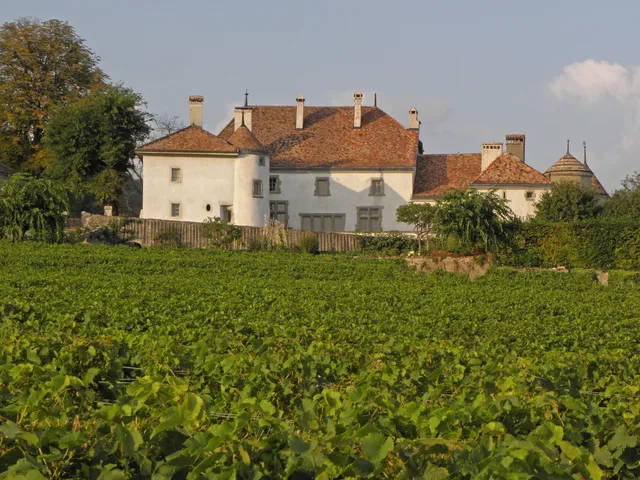
The forest here is threaded with a trail that connects four erratic boulders — Pierre à Roland, Pierre à Phébou, Pierre à Mille Trous, and Pierre à Ecuelles. Start in Gimel at La Fringale bakery for a coffee and a slice of tarte aux noix, then follow the yellow signs. The path dips into the Marais des Inversins marsh, where boardwalks keep your feet dry and dragonflies stitch the air. After the marsh, some sections go unsigned through dense forest — don't panic, just keep to the softest track and the next yellow marker will appear. Each boulder has a proper interpretive panel, the kind that doesn't dumb things down. You'll finish by descending past the Château du Rosay, Bursins into Bursins, one of Switzerland's officially most beautiful villages, where cellars pour the local Chasselas. The full loop from Gimel takes about three hours if you actually stop to touch the stones, which you should. Do it on a weekday and the woods will feel almost private.
Plan your visit
- Getting There
- No dedicated parking at the stone. Drive to Bursins or Burtigny village — from Bursins, the "En Folliausa" path starts on Route de Villebrande, on the left. From Burtigny, follow the marked Sentier des Pierres loop. Public transport: check sbb.ch for PostBus connections; there's no metro in these villages.
- Opening Hours
- Open-air natural site, no gates or staff. Accessible 24/7 year-round, weather permitting. As of 2026, no official closures. Summer 2026 brought a total open-air fire ban in Bursins due to drought — affects fire pits, not access.
- Time Needed
- Stone only: 15–30 minutes from the trail. Full Sentier des Pierres loop: 1h15–1h30 for 4.5 km. Longer Gimel–Bursins hike: 3h12 for 12.5 km.
- Accessibility
- Forest terrain, unpaved paths. Not wheelchair accessible. No elevators. The "easy" rating on the Sentier des Pierres applies to able-bodied hikers only.
- Cost
- Free. No tickets, no booking, no queue. Every day is free — the stone has never charged admission and shows no sign of starting.
History
A Thousand Holes and a Vanished Crown
The geological facts are not in dispute. Around 20,000 years ago, the Rhône glacier reached its Würm maximum and carried this block of sandstone into the Jura foothills, dropping it at 807 metres. The thousand holes are Auswitterungslöcher — weathering pits — produced by millennia of water etching weaker mineral seams. No ancient drill, no chisel.
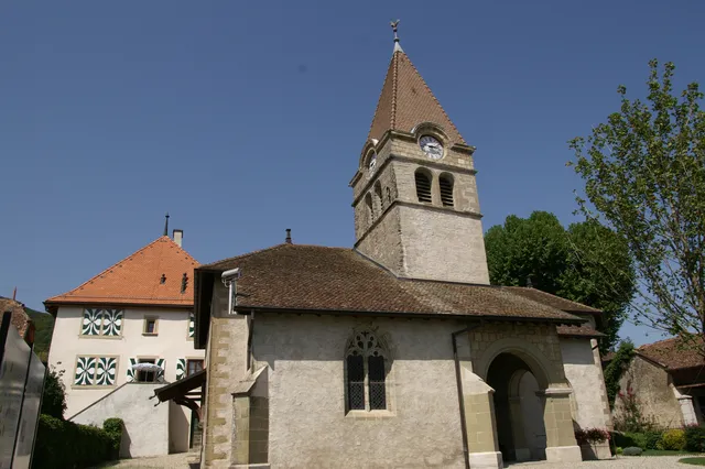
Human history here is thinner on the ground but no less dramatic. The nearest village of consequence, Bursins, appears in written record for the first time in 1011, when the last king of Burgundy signed it over to the monastery of Romainmôtier, a daughter house of Cluny. That act pulled this corner of Canton Vaud into a spiritual and political network whose architecture still stands at the Church of Saint-Martin, Bursins.
The turning point
The Last King's Signature
Long before the Stone of a Thousand Holes got its Goliath legend, the forest around it belonged to a failing crown. Rudolph III, last king of Burgundy, spent his reign losing battles to his own barons. He had no son, no military advantage, and no way to hold his realm together through force.
In 1011, Rudolph fixed his hopes on heaven. According to later transcriptions, he donated the village of Bursins — then called Brucins — to the monastery of Romainmôtier, under the authority of the powerful Abbot Odilo of Cluny. The gift was a spiritual insurance policy: land in exchange for prayers and a permanent foothold for the monks in this contested borderland. For Bursins, the charter is the oldest surviving document that names the place.
The turning point came with the seal. Rudolph’s name, Rodulfi regis, was pressed into the deed beside Odilo’s. When Rudolph died heirless in 1032, Burgundy was absorbed into the Holy Roman Empire, and the Cluniac lands around Bursins became an instrument of a new political order. The boulder in the forest had been waiting there for roughly 20,000 years, indifferent to every name and signature.
Diary of a Glacier
The Goliath Legend
Tips for visitors
Sturdy Shoes Only
Forest paths and unpaved roads, some sections "un peu plus raide." City shoes will regret this within ten minutes. Hiking boots or solid walking shoes.Skip the Drone
No photo restrictions at the stone, but the St-Oyens shooting range sits nearby. Flying a drone near an active range is asking for trouble. Casual photography is fine.Fuel Up in Gimel
Start at La Fringale bakery-tea room in Gimel for coffee and pastry, about 5–10 CHF. Bursins is Chasselas wine country — the Château du Rosay hosts wine events and tastings.Check the Forecast
At roughly 700m above Lake Geneva, weather shifts fast. The Le Pichounet viewpoint is exposed to wind. Bring a layer even in August.Walk the Full Loop
The stone is a waypoint, not a destination. The Sentier des Pierres loop links Pierre à Roland, Pierre à Phébou, and Pierre à Ecuelles — all four stones in one 4.5 km walk, with a viewpoint over the Church of Saint-Martin, Bursins on the descent.Fire Ban Alert
Summer 2026 brought a total open-air fire ban in Bursins due to drought. The fire pit at the En Folliausa viewpoint is off-limits during dry spells. Check bursins.ch before planning a cookout.
Frequently asked
Is Pierre à Mille Trous worth visiting?
Yes, if you like the idea of touching a piece of the Rhône glacier's journey — a multi-ton sandstone block that traveled here on ice 20,000 years ago. It's not a Stonehenge-style monument; it's a natural erratic with a honeycombed surface that looks almost lunar. Pair it with the Sentier des Pierres loop and the sudden Lake Geneva panorama, and it becomes a genuinely memorable half-day walk.
How long do you need at Pierre à Mille Trous?
Fifteen to thirty minutes at the stone itself is plenty — enough to circle it, run your fingers through the deeper holes, and read the interpretive panel. But the stone is a waypoint, not a destination. The full Sentier des Pierres loop takes about 1 hour 15 minutes to 1 hour 30 minutes, and that's the experience worth planning for.
How do I get to Pierre à Mille Trous?
You walk — there's no road to the stone itself. The standard approach is the Sentier des Pierres loop from Burtigny, a 4.5 km marked trail rated easy. You can also start from Gimel (at the La Fringale bakery) or approach from Bursins via the 'En Folliausa' path; the stone sits in the forest roughly on the boundary between Burtigny and Bursins.
What is the best time to visit Pierre à Mille Trous?
Late spring to early autumn gives you the most comfortable walking conditions, with wildflowers in spring and natural shade in summer. Autumn is arguably the most atmospheric — dry leaves crunch underfoot and the dark, pitted stone is framed by gold and red foliage. Winter is quietest, and frost or light snow collects in the holes in white circles against the dark sandstone.
Can you visit Pierre à Mille Trous for free?
Yes, completely free. It's an open-air natural site in a forest with no tickets, no gates, and no opening hours — accessible 24/7, year-round. The only costs are getting there and whatever you spend at the bakery in Gimel beforehand.
Why does Pierre à Mille Trous have holes?
The holes are natural weathering features called Auswitterungslöcher — differential erosion where softer minerals in the sandstone wore away faster than the surrounding harder material over millennia. Local legend offers a better story: Goliath was standing on the stone when David's sling struck him, and the holes are the marks of his fingers as he fell.
Is Pierre à Mille Trous natural or man-made?
The stone itself is natural — a glacial erratic deposited by the Rhône glacier — and the holes are natural weathering, not human carving. But the question of whether prehistoric people partially shaped or modified the stone remains genuinely unresolved. Some researchers argue it was selected and possibly worked for ritual purposes; no systematic archaeological excavation has ever been conducted to settle it.
What should I not miss at Pierre à Mille Trous?
Crouch down and look at the stone from ground level — the holes become a negative landscape, like craters on a miniature moon. Then run your fingers inside the deepest cavities; the interiors are smooth and almost polished, a tactile contrast with the rough, granular exterior. And don't skip the viewpoint at Le Pichounet just before the stone, where the forest suddenly opens toward Lake Geneva.
Sources & attribution 10
- Swiss Steindenkmäler Inventory (SSDI) — Official Swiss stone monuments inventory entry for Pierre à Mille Trous (Stone 1183.02, Canton Vaud), confirming its classification as a sandstone erratic with natural weathering holes.
- Commune de Burtigny — Sentier des Pierres — Official municipal page for the didactic trail, documenting the Goliath legend and the Rhône glacier's deposition of erratic blocks approximately 20,000 years ago.
- RTS — La Suisse mystérieuse: La pierre à mille trous — Swiss public television feature aired June 11, 2021, exploring the mystery of the erratic blocks around Burtigny, including Pierre à Mille Trous, Pierre à Roland, and Pierre à Phébou.
- Visinand.ch — Pierre à mille trous, Burtigny — Geological page with precise coordinates (46.466264 N, 6.273035 E), altitude (807 m), and physical description of the stone in the Folliausa forest east of Burtigny.
- RandoSuisse — Gimel–Bursins hike — Detailed hiking account describing the approach to the stone, the viewpoint at Le Pichounet, the Lake Geneva panorama, and practical details like the La Fringale bakery in Gimel.
- AllTrails — Sentier des Pierres — Trail listing with loop distance (4.5 km), average time (1 h 16 min), difficulty rating, and user reviews praising the explanatory panels at each stone.
- La Côte Tourisme — Le Sentier des Pierres, Burtigny — Regional tourism page describing the didactic trail as a journey 'between legend and reality,' with trail specifications and the 20,000-year glacial deposition context.
- Religiöse Geometrie — La Pierre à Mille Trous — Specialized research blog discussing the unresolved debate over possible human modification of the stone and its potential prehistoric significance, plus the related Pierre du Grison in Lignières.
- La Côte — Le passé sous nos pas (1/3) — Regional newspaper feature on the 'mysterious stones' of Burtigny, documenting local attitudes and the folk names attached to the erratic blocks.
- Commune de Bursins — Official website — Municipal website with practical information including the 'En Folliausa' path, picnic areas, and summer 2026 fire ban and water restrictions.
Built from cited sources · see the method · How we make our guides →
Next stop
More in Bursins.
3 places to discover — a few worth pairing.




Pick up where you left off
Saved and recently read places — kept on this device only.
Photo credits (2)
- Łukasz Szmigiel — Unsplash License (https://unsplash.com/license) — Source: https://images.unsplash.com/photo-1448375240586-882707db888b
- Kalen Emsley — Unsplash License (https://unsplash.com/license) — Source: https://images.unsplash.com/photo-1501785888041-af3ef285b470
Photos may have been resized or cropped.