Silent Coral Guns
Japanese gun emplacements on Betio still face the lagoon, their concrete cracked by coconut roots. You stand where the 76-hour Battle of Tarawa ended in 1943, the heat carrying whispers of the 6,200 lives lost here.
You step off the plane into air so thick it feels like a towel on your skin. A moment later, your feet sink into South Tarawa — a strip of coral and sand so narrow you can see the lagoon’s turquoise calm on one side, the ocean’s relentless blue on the other. Here in Kiribati, the mythology says this was the primordial earth, before a spider-god separated sky, sea, and land. The ghosts of that ancient sundering still feel close.
SYou step off the plane into air so thick it feels like a towel on your skin. A moment later, your feet sink into South Tarawa — a strip of coral and sand so narrow you can see the lagoon’s turquoise calm on one side, the ocean’s relentless blue on the other. Here in Kiribati, the mythology says this was the primordial earth, before a spider-god separated sky, sea, and land. The ghosts of that ancient sundering still feel close.
This isn't an island, not in the postcard sense. South Tarawa is a ribbon of land linking a chain of islets, a precarious home for over half the nation’s people. The architecture tells the story: the grand parliament building stands on Ambo, its white concrete a sharp modern statement, while between the urban centers you’ll still see homes with pandanus-leaf roofs that last for years in the equatorial rains. The walls are woven from palm mats. No insulation is needed here.
Walk past the sacred heart cathedral and you’ll see shoes lined up outside. Step in and find a cool, empty floor where the congregation sits. The light filters through stained glass onto high wooden beams. It’s quiet. This is a country where people descend from master navigators who settled these atolls over two thousand years ago. The sea isn’t just a view; it’s their library, highway, and larder.
What makes this place worth slowing down for.
Japanese gun emplacements on Betio still face the lagoon, their concrete cracked by coconut roots. You stand where the 76-hour Battle of Tarawa ended in 1943, the heat carrying whispers of the 6,200 lives lost here.
The I-Kiribati descend from master navigators who settled these atolls around 200 BC. Watch fishermen in outrigger canoes on the lagoon, practicing techniques that read wave patterns and stars as their ancestors did.
Walk into Sacred Heart Cathedral and leave your shoes at the door. The congregation sits on the floor under high wooden beams, a custom that turns the space into a vast, shared mwaneaba—a meeting house for the soul.
Where to wander, by quarter — each with its own rhythm.
This westernmost islet is where history washed up and never quite left. The Japanese gun emplacements at Red Beach 2 still stare out to sea, their concrete pocked and silent. Nearby, the small Betio WWII Museum charges about three dollars to tell the story of the brutal 76-hour fight. The real texture, though, is along the lagoon-side port. Fishermen line the quay in the afternoon light, and behind them, the rusting hulks of the ship cemetery break the water's perfect surface.
The administrative pulse of the atoll. The State House, where the president’s flag flies, isn’t open to visitors but its white exterior makes a clear statement against the blue sky. It’s a place of government business, of quiet streets that feel more ordered than the denser settlements to the west. You come here to see the machinery of a nation that exists on the frontier of the map.
A destination for a drive, mainly for the view. The parliament building, relocated here in 2000, is the photogenic prize. The road offers sweeping ocean vistas, but bring your own air conditioning — a vehicle without it turns the trip into a sauna on wheels. It’s scenic, stark, and reminds you how small this land really is.
More than just the museum, though that’s the anchor. The New Zealand-funded building, free to enter, holds shark-tooth weapons, models of outrigger canoes, and photos of a way of life predating everything else here. Outside stands a full-sized *mwaneaba*, a traditional meeting house with a soaring thatched roof. It’s a place of quiet study, where you can trace the line from the giant clamshell displays to the heart-shaped fish traps still used on the outer reef.
Small things that change how the city treats you.
Public transport is limited to shared taxis and buses that don't run to a fixed schedule. An air-conditioned rental car is the most practical way to explore the atoll's length, especially in the extreme heat.
Before entering Sacred Heart Cathedral, take off your shoes. The congregation sits directly on the floor, a practice that keeps the space clean and honors local custom.
Australian dollars are the official currency. Credit cards are rarely accepted outside the main hotels and a handful of larger stores. Small bills are essential for markets and local vendors.
The equatorial sun is intense year-round. Bring high-SPF sunscreen, a wide-brimmed hat, and a reusable water bottle. Drink constantly, even if you don't feel thirsty.
Always ask permission before taking photos of people, especially in villages. This is a basic courtesy, and a simple smile and nod will usually get you a positive response.
The city, as it actually looks.

Visitors enjoy the serene, shallow turquoise waters of South Tarawa, Kiribati, set against a stunning backdrop of dramatic clouds.
Baz R on Pexels

A stunning aerial perspective of the lush coastline and vibrant turquoise waters of South Tarawa, Kiribati.
Asad Photo Maldives on Pexels
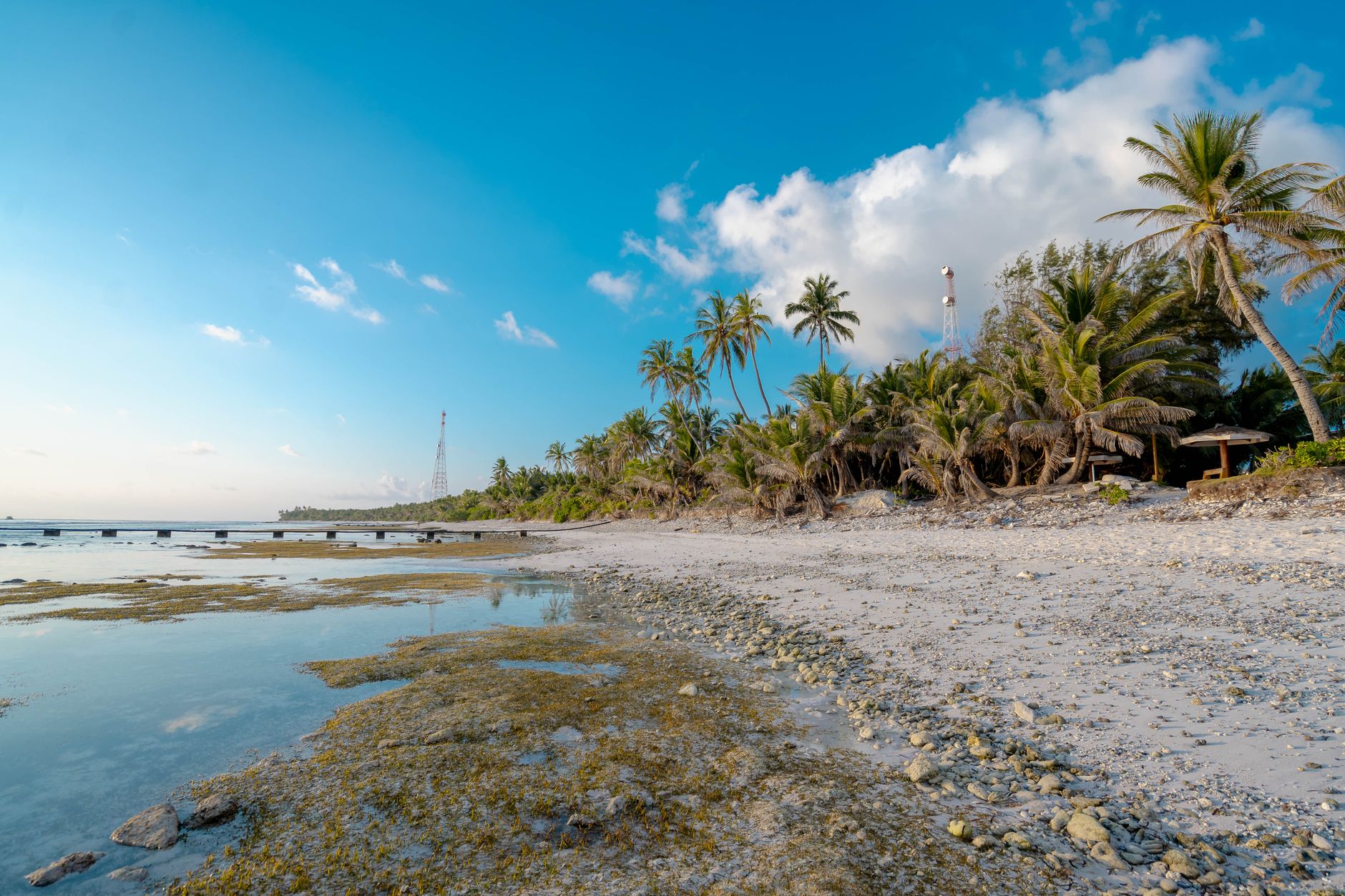
A serene coastal landscape in South Tarawa, Kiribati, showcasing a wooden pier extending into the shallow waters alongside a tropical palm-lined beach.
Asad Photo Maldives on Pexels

The golden glow of sunset illuminates the tranquil shoreline and lush palm trees of South Tarawa, Kiribati.
Maahid Photos on Pexels
Yes, if you're after raw history and cultural immersion rather than a beach resort. The WWII relics on Betio are some of the most concentrated and untouched in the Pacific. You come for the sobering battlefields, the masterful seafaring heritage, and to see a nation on the climate frontline.
Three to four days is sufficient. One day for the Betio WWII sites and ship cemetery, another for the cultural museum and Parliament drive, and a third to absorb the pace of life and visit the fish traps at low tide. It's a compact atoll, but the heat demands a slow pace.
Violent crime is rare, but petty theft can occur. Use common sense: don't leave valuables unattended, especially on beaches. The main hazards are environmental—intense sun, strong currents on the ocean side, and occasional flooding during king tides.
Renting a car is the most reliable option. The main road runs the length of the atoll, connecting Betio to Bonriki Airport. Shared taxis and buses operate informally; flag them down, but be prepared for irregular schedules and crowded vehicles.
Expect simple, staple-based meals. Fresh fish and seafood are common, along with rice, breadfruit, and taro. Coconut features in many dishes. Imported goods are expensive. Try the local sashimi (ota ika) if you get a chance.
Ready to book?
Bonriki International Airport (TRW) on South Tarawa is the only international gateway. In 2026, Fiji Airways offers the most frequent connections from Nadi (NAN). Expect a short, hot walk from the tarmac to the small terminal building.
There is no public transit system. Travel happens via hired car with a driver, shared minibuses, or taxis. The main road runs 30 km from Betio to Tanaea. Rent a bicycle for local exploration, but prepare for relentless equatorial sun.
The temperature sits between 28°C and 32°C year-round. Humidity is constant. The dry season runs from April to October. November to March brings heavier rain and stronger winds. Visit during the dry months—the heat is more manageable.
Gilbertese (I-Kiribati) is the everyday language. English is used in government and business. The currency is the Australian dollar (AUD). Credit cards are rarely accepted outside major hotels; carry cash in small denominations.
0 places, one continuous walking route. Free with your first city.