Introduction: The Pont de Normandie – History and Significance
The Pont de Normandie is a monumental feat of modern engineering and a symbol of unity in Normandy, France. Officially inaugurated in 1995, this elegant cable-stayed bridge spans the Seine estuary, linking the industrial port city of Le Havre with the picturesque town of Honfleur. Beyond its essential transport role, the Pont de Normandie stands as a regional icon celebrated for its innovative design, record-breaking span, and harmonious presence within the Normandy landscape.
This comprehensive guide offers everything you need to plan a visit: from historical and architectural background to practical tips on visiting hours, tickets, accessibility, travel options, and nearby attractions. Whether you cross by car, bicycle, on foot, or enjoy a boat tour beneath its soaring pylons, the Pont de Normandie is a must-see for travelers interested in engineering, culture, and natural beauty.
The bridge’s design also embodies a commitment to environmental stewardship, minimizing ecological impact on the sensitive Seine estuary while promoting sustainable mobility through dedicated pedestrian and cycling paths. With easy access to nearby highlights such as the UNESCO-listed city of Le Havre, the charming harbor town of Honfleur, and regional nature reserves, your visit can be enriched by Normandy’s cultural and ecological treasures.
For the latest details on tolls, opening hours, and guided tour options, always consult the official Pont de Normandie website and local tourism offices. This guide synthesizes authoritative sources to provide accurate, up-to-date information for a safe, enjoyable, and memorable experience (France Bleu; Choose Normandy; Lonely Planet).
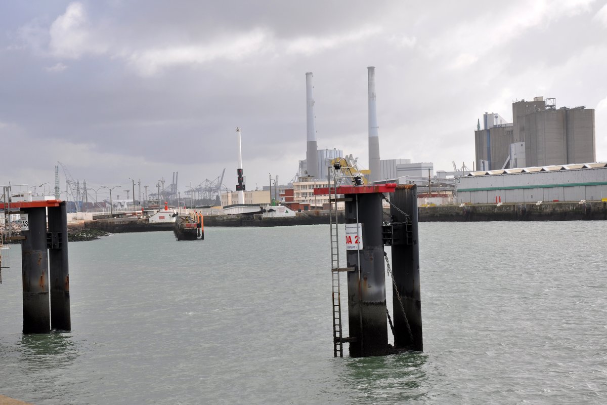
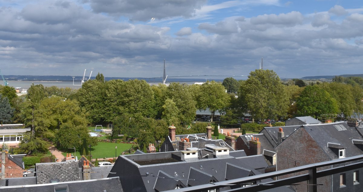
Photo Gallery
Explore Pont De Normandie in Pictures

Historical Background and Architectural Significance
Regional Context and Conception
The Pont de Normandie was conceived to address the growing need for direct, efficient transport between Le Havre and Honfleur, and more broadly, between the regions of Haute-Normandie and Basse-Normandie. Before its construction, the closest crossing at the river's mouth was the Tancarville Bridge, opened in 1959, which itself had revolutionized regional access (Tour de France Bridges). By the mid-1970s, the Chamber of Commerce and Industry (CCI) of Le Havre began advocating for a new crossing, culminating in multi-regional support by 1987.
Construction Timeline and Engineering Feats
Construction began in 1988 and took seven years, with the bridge inaugurated on January 20, 1995. Nearly 1,600 workers contributed to the project, and the total investment reached approximately $465 million (AZO Build). Designed by engineer Michel Virlogeux and architects François Doyelle, Charles Lavigne, and Alain Montois, the Pont de Normandie set two world records upon completion: the longest cable-stayed bridge by central span (856 meters) and by total length (2,141 meters) (B2 World Bridges).
Socio-Economic Impact
Since opening, the bridge has dramatically improved regional mobility, commerce, and cultural exchange. Daily crossings have tripled, now averaging 22,000 vehicles per day, and the bridge has significantly shortened travel distances and times between key Normandy destinations (France Bleu).
Architectural Features and Visual Impact
Design Innovations and Structure
The Pont de Normandie is an iconic cable-stayed bridge supported by 184 Freyssinet cables anchored to two inverted Y-shaped pylons, each soaring to 214 meters. Its deck is 23.6 meters wide, accommodating four lanes of vehicular traffic and separated pedestrian and cycling paths (Lonely Planet). The bridge’s hybrid structure combines pre-stressed concrete and steel for optimal strength and durability.
Maintenance and Durability
A hallmark of the design is the ability to replace individual cable stays without disrupting traffic, ensuring efficient long-term maintenance (Tour de France Bridges). Rigorous testing, including 16,000 tonnes of lorries for load testing, was performed before the bridge opened to the public (AZO Build).
Cultural and Environmental Integration
The Pont de Normandie’s striking profile is visible for miles and has become a regional symbol of progress and unity. Its design minimizes environmental impact, with long spans reducing the number of supports in the estuary. The bridge blends seamlessly with its natural surroundings, and its elevated deck allows unrestricted river navigation (Choose Normandy).
Environmental considerations guided construction, with close coordination to protect the Natura 2000 Seine Estuary, a biodiversity hotspot for migratory birds and aquatic life. Ongoing monitoring and stewardship help maintain the delicate balance between infrastructure and ecosystem (Wikipedia).
Visitor Information
Visiting Hours
- Vehicles: The bridge is open 24/7 for motorized traffic.
- Pedestrians and Cyclists: Access is generally available dawn to dusk; visit during daylight for safety and maximum enjoyment.
- Maison de l’Estuaire Visitor Center: Open Wednesdays, Saturdays, and Sundays from 2:00 pm to 6:00 pm, March 3 to October 31. Guided tours available by appointment.
Tickets and Access
- Pedestrian and Cyclist Access: Free of charge; use dedicated paths.
- Vehicular Toll: As of 2025:
- Standard cars: €5.50
- Class 2: €6.40
- Class 3: €7.00
- Class 4: €13.80
Payment is via credit card, cash (coins), or electronic Télépéage. Most toll lanes accept cards; some accept cash (lehavre-etretat-tourisme.com).
Accessibility
- Pedestrian Paths: Wheelchair accessible, but the bridge’s length (over 2 km) and incline may challenge some visitors.
- Cycling: Dedicated but narrow lanes; strong winds and traffic proximity require caution. Inexperienced cyclists may prefer the local bus service with bike transport (normandie-tourisme.fr).
- Parking: Available on both Le Havre and Honfleur sides, near toll plazas and access points.
Travel Tips and Safety
- Best Time to Visit: Early morning or late afternoon for ideal lighting and fewer crowds. In summer, daylight extends from before 6 am to after 10 pm (normandielovers.fr).
- Weather: The bridge can be windy; dress appropriately in layers, bring rain gear, and secure loose items.
- Duration: Allow 1.5–2 hours for a round-trip walk, plus time for photos and exhibitions.
- What to Bring: Comfortable shoes, windproof jacket, water, camera, sun protection, and binoculars.
Parking and Visitor Facilities
- Parking: Ample parking is available on both Honfleur and Le Havre sides.
- Restrooms & Amenities: Facilities at Maison de l’Estuaire and local visitor centers; none on the bridge itself (lehavre-etretat-tourisme.com).
Nearby Attractions
- Le Havre: Explore the UNESCO-listed city center, museums, and port.
- Honfleur: Discover the old harbor, art galleries, and historic streets.
- Seine Estuary: Enjoy boat tours, birdwatching, and the nature reserve.
- Jardin des Ingénieurs: Educational displays near the Le Havre tolls.
- Boat Tours: Sightseeing cruises from Honfleur under the bridge (ot-honfleur.fr).
Special Events and Guided Tours
- Maison de l’Estuaire: Free exhibitions and guided tours focus on estuarine ecology and bridge construction. Group tours by prior request.
- Boat Tours: Narrated cruises from Honfleur offer unique perspectives on the bridge and estuary (ot-honfleur.fr).
- Cultural Events: Occasional cycling races and festivals highlight the bridge’s role in regional life.
Frequently Asked Questions (FAQs)
Is the Pont de Normandie open to pedestrians and cyclists?
Yes, both can cross free of charge using dedicated paths.
Are tickets required?
No for pedestrians/cyclists; yes for vehicles (toll applies).
Are guided tours available?
Yes, at Maison de l’Estuaire and via boat tours from Honfleur.
Is the bridge wheelchair accessible?
The pedestrian path is accessible, but the incline may be challenging.
Where can I park?
Parking is available on both Le Havre and Honfleur sides.
What are the best photo spots?
The bridge midpoint, Esplanade of the Sails of Liberty in Berville-sur-Mer, and Honfleur’s harbor provide great views.
What should I bring?
Comfortable shoes, windproof clothing, water, camera, and sun protection.
Visual Gallery

The iconic sweeping cable stays and pylons of the Pont de Normandie.

Dedicated pedestrian and cycling paths offer spectacular views of the Seine estuary.

The bridge illuminated at sunset, a favorite for photographers.
Listen to the full story in the app
Your Personal Curator, in Your Pocket.
Audio guides for 1,100+ cities across 96 countries. History, stories, and local insight — offline ready.
Audiala App
Available on iOS & Android
Join 50k+ Curators
Sources
- verified
- verified
- verified
- verified
- verified
Last reviewed: