Ap Lei Chau Bridge
Hong KongHong Kong 22° N · 114° E Updated Apr 2026
Inside this 230-metre bridge deck, water for 80,000 people flows invisibly. The 1980 crossing nearly failed mid-build — nothing on its surface shows it.
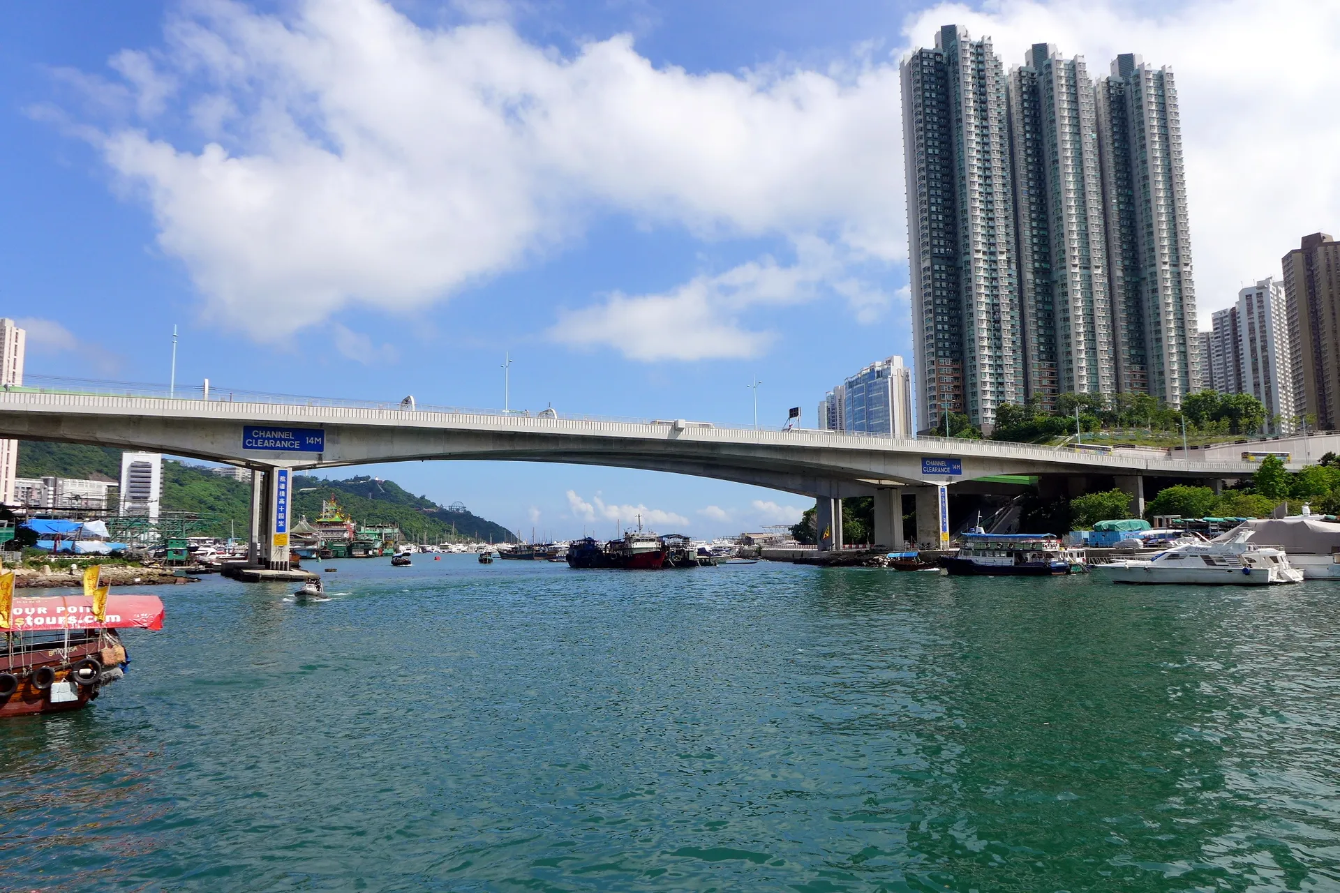 Photo: Wing1990hk · CC BY 3.0
- Time needed
- 20–30 minutes
- Entry
- Free
- Access
- Flat, step-free pedestrian walkways on both sides; Lei Tung MTR Exit A2 has a lift
- Best season
- October–December (cool, clear, low humidity)
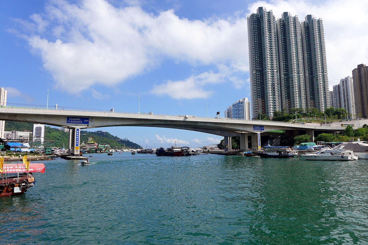
Somewhere inside the grey concrete deck of Ap Lei Chau Bridge, two halves that were never supposed to meet sit joined by an emergency fix so precise that forty-six years of traffic haven't revealed the seam. This 230-metre crossing — roughly two football pitches laid end to end — spans the Aberdeen Channel in southern Hong Kong, connecting the island of Ap Lei Chau to the rest of the territory. Walk across and you get salt air, the low hum of a bus vibrating through the railings, and a harbour view that most Hong Kong visitors never bother to find.
Before 28 March 1980, the only way to reach Ap Lei Chau was by sampan. Tanka fishermen lived in floating villages on the channel, and the island felt like another country despite sitting a four-minute boat ride from the Aberdeen waterfront. The bridge changed that arithmetic overnight.
Today three structures cross the channel in tight parallel: the original 1980 road bridge, its 1994 duplicate, and a driverless MTR railway bridge that opened in December 2016. Together they carry cars, trains, pedestrians, and — hidden inside the hollow box girder of the first bridge — the water supply for roughly 80,000 residents. The infrastructure is stacked like a geological cross-section of Hong Kong's growth.
None of this registers as a tourist destination. No signs point you here, no gift shop waits on the far side. Ap Lei Chau Bridge is Hong Kong's working skeleton, visible for once, and the fifteen-minute walk across it tells you more about the city than most museums manage in an afternoon.
What to see
-
The Bridge Midpoint and Aberdeen Channel
Stop halfway across. The railings vibrate faintly when a double-decker bus passes — locals call it the bridge breathing. Look down and the Aberdeen Channel sits fourteen metres below, about four storeys of air between your feet and the water, close enough to smell salt and diesel. To the north, the MTR's South Island Line trains glide past at near-eye level every few minutes: small white-and-green three-car sets, almost silent, driverless. The midpoint is also where Peter Hines's emergency correction sits buried in the concrete — the precise spot where two misaligned cantilever arms were coaxed into meeting. You will never see the join. That is the point. -
The Sampan Crossing
For HK$2.50 — less than a third of a US dollar — you can cross the Aberdeen Channel the pre-1980 way. The kaito sampan service still runs between the Aberdeen and Ap Lei Chau promenades: no timetable, no app, just wave from the dock and a boat putters over. The ride takes about three minutes and puts you at water level, looking up at the bridge's underside and the massive concrete piers that displaced the Tanka floating village. Take the sampan before or after walking the bridge. The contrast between crossing over and crossing under tells you everything about how Hong Kong layers its infrastructure on top of the lives that came before. -
Where the Jumbo Kingdom Used to Float
Look south from the bridge's western end and you will see open water where Hong Kong's most famous floating restaurant once sat. The Jumbo Kingdom — three storeys of imperial-kitsch dining, neon-lit and enormous — occupied this stretch of the Aberdeen Channel for decades. In June 2022, it sank in the South China Sea during a tow to a dry dock. The space it left is just harbour now, unremarkable, which makes it stranger. Locals still glance at the empty spot. The absence is the landmark.
Plan your visit
- Getting There
- Take the South Island Line to Lei Tung Station (Exit A2) — 15 minutes from Admiralty, then an 8-minute walk east to the bridge. Bus routes 90, 91, 592, and A10 all cross or stop nearby. For the atmospheric approach, catch a kaito sampan from Aberdeen Promenade for HK$2.50 — no timetable, just wave one down.
- Opening Hours
- As of 2026, the bridge is a public road open 24 hours a day, 365 days a year — no gate, no ticket, no closing time. The one exception: pedestrian access may be restricted during Typhoon Signal No. 8 or above, typically between June and September.
- Time Needed
- Walking across takes 5–7 minutes at a normal pace. Budget 20–30 minutes if you want to stop at the midpoint, watch the silent MTR trains glide past at eye level, and take in the Aberdeen Channel. Combine it with the Aberdeen waterfront promenade and you have a satisfying hour.
- Accessibility
- Flat, paved, step-free pedestrian walkways run along both sides of the bridge — fully wheelchair accessible. Lei Tung MTR Exit A2 has a lift. Note that the pedestrian crossing near the south approach has temporary barriers through 2026 for visibility improvements, which may require a short detour.
Photo Gallery




History
The Gap That Wouldn't Close
Hong Kong builds fast and builds over itself. Ap Lei Chau Bridge is one of the rare pieces of infrastructure where the construction drama left a trace — invisible to the eye, but documented in an engineer's memoir and a newspaper obituary. The bridge was supposed to be routine. It wasn't.
Construction began in April 1977 under Maunsell & Partners, the consulting engineers behind dozens of Hong Kong's post-war crossings. The design was a double-cantilever in prestressed concrete: two arms extending from opposite piers, meeting in the middle like hands clasping over tidal water. A proven technique. Except the hands didn't reach.
The turning point
Peter Hines and the Crisis at Midspan
Peter Hines was the resident engineer on site, the person responsible for translating drawings into concrete and steel over moving water. Partway through construction, he discovered that the two cantilever arms extending from opposite piers were not going to meet at the centre of the channel. The geometry was off. In prestressed concrete, where every tendon is tensioned to a precise calculation, you cannot solve this by adding a few centimetres of filler.
Hines devised an emergency mid-construction correction — adjusting the alignment of already-set, already-stressed concrete segments so the two halves could close. The technical details he later described in his memoir, Beanz means Hines, read like defusing a bomb while the timer runs. Every correction risked cracking what was already built.
The bridge opened on 28 March 1980. One lane in each direction. Nothing in the smooth grey deck betrays the crisis. When Hines died in January 2021, The Telegraph's obituary mentioned Ap Lei Chau Bridge by name — the quiet fix on a small crossing in southern Hong Kong, remembered precisely because it worked so well that nobody noticed.
The Fishermen Who Disappeared
A Second Bridge and a Blocked View
Tips for visitors
Time Your Crossing
Late afternoon gives you the best light on the Aberdeen Channel and a breeze off the water. In August, the bridge offers zero shade at 90% humidity — early morning or after 5 pm saves you from feeling like you're breathing through a wet towel.Midpoint Is the Shot
Stop at the bridge's centre for the three-bridge view: road, rail, and the MTR's driverless trains passing almost silently at your eye level every few minutes. The empty water where Jumbo Kingdom's floating restaurant sat until it sank in 2022 is visible from here too — locals still do a double-take at the gap.Eat in Aberdeen Market
Skip anything on the Ap Lei Chau side of the bridge and walk 10 minutes west along Aberdeen Promenade to the Aberdeen Municipal Services Building cooked food centre. Budget dai pai dong stalls serve congee and fish ball noodles for under HK$50. For seafood at mid-range prices, the restaurants lining Aberdeen's waterfront do it fresh off the boats.Combine with the Promenade
The Aberdeen–Ap Lei Chau waterfront promenade connects to the bridge on both sides. Walk it as a loop: cross the bridge, follow the Ap Lei Chau shoreline south, then take the sampan back to Aberdeen for HK$2.50. The whole circuit takes about an hour and gives you the bridge from every angle.Winter Northeast Monsoon
Between November and February, the northeast monsoon funnels straight through the Aberdeen Channel. The bridge crossing turns bracing — bring a layer. The upside: the air is dry and clear, and the harbour views are the sharpest you'll get all year.
Frequently asked
Is Ap Lei Chau Bridge worth visiting?
Yes, if you care about engineering history or want a free vantage point over Aberdeen Harbour. The bridge looks unremarkable from a distance, but the story behind it — a mid-construction crisis that nearly left two concrete arms permanently misaligned — makes the crossing read differently once you know it. The nearby kaito sampan adds a five-minute perspective from the water that most visitors skip.
How long do you need at Ap Lei Chau Bridge?
Twenty to thirty minutes covers a full crossing and back. Allow longer if you want to linger at the midpoint where the two 1980 cantilever arms meet, or combine it with the Aberdeen waterfront promenade on the north side.
How do I get to Ap Lei Chau Bridge by MTR?
Take the South Island Line to Lei Tung Station and use Exit A2, which has a lift. The bridge is a five-to-eight minute walk east. From Admiralty, the journey takes roughly 15 minutes.
Is Ap Lei Chau Bridge free to visit?
Completely free. It's a public road with pedestrian walkways on both sides, open 24 hours a day. No admission, no booking, no barriers — though it may close to pedestrians during Typhoon Signal No. 8 or above.
Can you walk across Ap Lei Chau Bridge?
Yes. Flat, paved pedestrian walkways run along both sides and are step-free throughout. The crossing is 230 metres — roughly two football pitches end to end — and takes about five minutes at an easy pace.
What is Ap Lei Chau Bridge famous for?
Primarily for an engineering near-disaster that left no visible trace. During construction in the late 1970s, resident engineer Peter Hines discovered the two prestressed-concrete cantilever arms were on course to miss each other at the centre. He devised a mid-construction geometric correction, and the bridge opened in March 1980 looking exactly as planned. His account of the crisis appears in his memoir, Beanz means Hines.
How many bridges cross the Aberdeen Channel at Ap Lei Chau?
Three, running in close parallel. The original 1980 road bridge carries westbound traffic; a second near-identical bridge completed in July 1994 carries eastbound traffic; and the Aberdeen Channel Bridge, opened December 2016, carries driverless MTR South Island Line trains. Road, rail, and — inside the original hollow deck — a water main serving around 80,000 residents, all crossing the same 230-metre gap.
What is the best time to visit Ap Lei Chau Bridge?
October to December, when the northeast monsoon clears the humidity and the light over Aberdeen Harbour turns sharp. August crossings are possible but 90% humidity and no shade on the deck make them an endurance test rather than a pleasure.
Sources & attribution 6
- Wikipedia — Ap Lei Chau Bridge — Construction dates, costs, engineering details, Maunsell & Partners credit, second bridge opening ceremony and cost (HK$64M), MTR Aberdeen Channel Bridge opening date
- audiala.com — Ap Lei Chau Bridge — Opening date (28 March 1980), Tanka fishermen displacement, water pipe inside hollow deck, sensory details (salt-and-diesel smell, monsoon conditions), Jumbo Kingdom sinking 2022, political note on second bridge siting
- The Telegraph — Obituary of Peter Hines, 25 January 2021 — Confirmed Peter Hines as resident engineer; primary narrative source for the cantilever alignment crisis
- Peter Hines — Beanz means Hines (ISBN 978-1-71-456394-4) — Author's first-person account of the mid-construction engineering correction; cited in Wikipedia
- South China Morning Post (via Wikipedia citations) — Second bridge funding approval by LegCo (1 May 1991), opening ceremony details (28 July 1994), first to drive across: Director of Highways Kwong Hon-sang
- Tripadvisor — Ap Lei Chau Bridge visitor reviews — Confirmed 230-metre span; kaito sampan fare (HK$2.50) and flagging procedure from Aberdeen promenade
Built from cited sources · see the method · How we make our guides →
More in Hong Kong.
86 places to discover — a few worth pairing.

Pick up where you left off
Saved and recently read places — kept on this device only.
Photo credits (12)
- Ap Lei Chau Bridge 201508 — Wing1990hk — CC BY 3.0 (https://creativecommons.org/licenses/by/3.0/) — Source: https://commons.wikimedia.org/wiki/File:Ap_Lei_Chau_Bridge_201508.jpg
- Ap Lei Chau Brdiege 03-12-2016 — LN9267 — CC BY-SA 4.0 (https://creativecommons.org/licenses/by-sa/4.0/) — Source: https://commons.wikimedia.org/wiki/File:Ap_Lei_Chau_Brdiege_03-12-2016.jpg
- Ap Lei Chau Bridge (North) Children's Playground 2024 — Tombus20032000 — CC BY-SA 4.0 (https://creativecommons.org/licenses/by-sa/4.0/) — Source: https://commons.wikimedia.org/wiki/File:Ap_Lei_Chau_Bridge_(North)_Children's_Playground_2024.jpg
- Ap Lei Chau Bridge 2013 — Ceeseven — CC BY-SA 3.0 (https://creativecommons.org/licenses/by-sa/3.0/) — Source: https://commons.wikimedia.org/wiki/File:Ap_Lei_Chau_Bridge_2013.jpg
- Ap Lei Chau Bridge North Side — Ceeseven — CC BY-SA 4.0 (https://creativecommons.org/licenses/by-sa/4.0/) — Source: https://commons.wikimedia.org/wiki/File:Ap_Lei_Chau_Bridge_North_Side.jpg
- Aberdeen Typhoon Shelter 11-05-2016 — LN9267 — CC BY-SA 4.0 (https://creativecommons.org/licenses/by-sa/4.0/) — Source: https://commons.wikimedia.org/wiki/File:Aberdeen_Typhoon_Shelter_11-05-2016.jpg
- Aberdeen HONG KONG - panoramio — Joe Man — CC BY 3.0 (https://creativecommons.org/licenses/by/3.0/) — Source: https://commons.wikimedia.org/wiki/File:Aberdeen_HONG_KONG_-_panoramio.jpg
- Ap Lei Chau Bridge 29-08-2017(2) — LN9267 — CC BY-SA 4.0 (https://creativecommons.org/licenses/by-sa/4.0/) — Source: https://commons.wikimedia.org/wiki/File:Ap_Lei_Chau_Bridge_29-08-2017(2).jpg
- Ap Lei Chau Bridge 2025 — Tombus20032000 — CC BY-SA 4.0 (https://creativecommons.org/licenses/by-sa/4.0/) — Source: https://commons.wikimedia.org/wiki/File:Ap_Lei_Chau_Bridge_2025.jpg
- Ap Lei Chau Bridge 29-08-2017 — LN9267 — CC BY-SA 4.0 (https://creativecommons.org/licenses/by-sa/4.0/) — Source: https://commons.wikimedia.org/wiki/File:Ap_Lei_Chau_Bridge_29-08-2017.jpg
- Ap Lei Chau Bridge at Ap Lei Chau side — Ceeseven — CC BY-SA 4.0 (https://creativecommons.org/licenses/by-sa/4.0/) — Source: https://commons.wikimedia.org/wiki/File:Ap_Lei_Chau_Bridge_at_Ap_Lei_Chau_side.jpg
- Ap Lei Chau Bridge in 2014 — Ceeseven — CC BY-SA 4.0 (https://creativecommons.org/licenses/by-sa/4.0/) — Source: https://commons.wikimedia.org/wiki/File:Ap_Lei_Chau_Bridge_in_2014.JPG
Photos may have been resized or cropped.