
An introduction.
Researched by the Audiala editorial team from historical records, architectural archives, and local expertise.
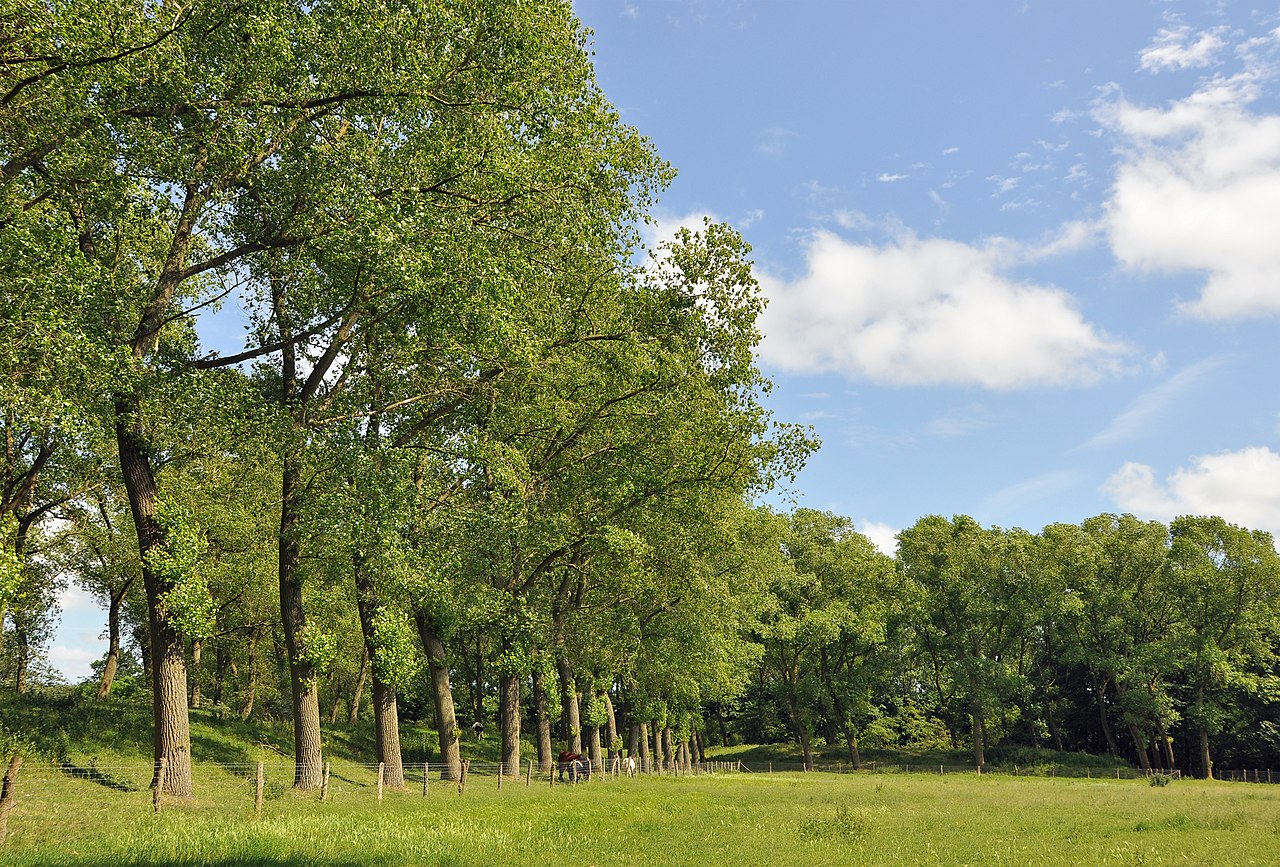
AA ring of earth rises out of the flat fields at Fort van Beieren, and for a moment Bruges, Belgium stops looking like a city of gables and canals and starts looking like a war map left in the rain. That surprise is exactly why you should come: this is where military engineering, farm life, and wetland silence ended up sharing the same ground. Fort van Beieren sits in Koolkerke, just northeast of Bruges proper, and it rewards visitors who want something stranger and quieter than postcard Bruges.
Most people picture stone walls when they hear the word fort. Fort van Beieren gives you packed earth, broad moats, angled bastions, and paths that curve the way cannon fire once demanded.
The province's restoration work made the shape readable again, especially on the northern side, but the place still feels half-wild. Reeds move in the ditch water, wind crosses the open square, and the whole site carries that damp polder smell of grass, mud, and old water.
If you've already spent time in Bruges or paused at Ezelpoort, this fort changes the city's story. Bruges was never only belfries and merchant houses; it was defended by geometry, mud, and a lot of labor with shovels.
01 What to see.
The Northern Bastion and Moat
The Central Square
The Estate Edge
02 In pictures.


Plan and listen to Fort Van Beieren with Audiala.
Audio guide in your pocket, itinerary in your browser. Built for the way you actually visit.
03 Visitor logistics.
The practical scaffolding for a good visit — kept short.
Getting There
Fort Van Beieren sits in Koolkerke on the northeast edge of Bruges, with the main entrance on Kasteeldreef and another approach from Noorweegse Kaai along the Damse Vaart. By public transport, De Lijn line 6 runs from Bruges station toward Koolkerke and stops at "Fort Van Beieren"; from the stop, the fort is a short walk. From central Bruges, cycling usually takes about 15 to 20 minutes, and walking from Ezelpoort takes roughly 40 to 50 minutes via Koolkerkse Steenweg.
Opening Hours
As of 2026, the provincial domain is open daily from sunrise to sunset rather than on fixed clock hours. The on-site Fort van Beieren Brasserie opens from 11:00 and is closed on Mondays and Tuesdays, and the public toilet at Gemeneweidestraat 51 is listed by the City of Bruges as open Wednesday to Sunday from 11:00 to 24:00.
Time Needed
Give the place 45 to 60 minutes if you want one quiet loop over the earthworks and back. A fuller visit takes 90 minutes to 2 hours if you add the 2 km Fortwandeling, linger on the bastions, or continue onto the 3.3 km Damse Vaart walking route. Families using the natural play area and QR lookouts can easily spend half a day here.
Accessibility
The province lists Fort Van Beieren as wheelchair accessible and provides an accessible ground plan, which usually means the main approach paths are the safest choice. Earthen ramparts, sloped bastions, and moister stretches near the ditches can turn uneven after rain, so visitors with limited mobility should stick to the broad established paths and avoid assuming every embankment route is smooth.
Cost & Tickets
As of 2026, access to the fort grounds is free. The main paid extra currently advertised on site is the permanent Safari Quest for children aged 6 to 14, priced at 9.99 euros; everything else, from walking the fort to using the outdoor domain, costs nothing.
05 Tips for visitors.
Small things that change the day.
Go Late
Late afternoon suits this fort better than noon. Low light catches the folds of the earthworks, and the bastions start reading like military geometry instead of a pleasant patch of trees.
Add The Canal
Don’t treat this as a stand-alone stop unless you live nearby. Pair the 2 km fort loop with the 3.3 km Damse Vaart route, or ride out from Bruges and make the fort your quiet northern detour.
Watch The Ground
Packed earth behaves well in dry weather and badly after rain. The bastion slopes and ditch edges can get slick and uneven, so save the higher embankments for a dry day and keep to the broader paths if the ground feels spongy.
Use The Lookouts
Head for the restored northwest bastion, where five wooden viewing posts point toward specific features in the surrounding polders. The QR codes matter here; without them, you see open country, with them, the whole 25-hectare fort starts making sense.
Plan Facilities
Toilets are not an all-day guarantee. The public toilet by Gemeneweidestraat 51 is listed as open Wednesday to Sunday from 11:00 to midnight, and the brasserie also starts service from 11:00 and stays closed on Mondays and Tuesdays.
Dog Rules
Dogs are welcome, but the default rule is leash on, including the parking area. Fort Van Beieren also has a dedicated dog run of about 2,200 square meters, so let your dog off only there unless you want a conversation with local regulations.
Where to Eat
Don't Leave Without Trying
Dining Tips
- check Book ahead for Friday and Saturday dinner, especially in small, popular rooms.
- check Do not assume restaurants open seven days a week; Sunday and Monday closures are common in Bruges.
- check Lunch usually runs around 12:00-14:00, and dinner around 19:00-20:00.
- check Many kitchens stop serving earlier than in southern Europe, often around 21:00-22:00.
- check Tipping is not required in Belgium because service is usually included; rounding up or leaving a few euros is normal if service was especially good.
- check Bring a card. Electronic payment is standard, and businesses must offer at least one electronic payment method.
- check Keep some cash for markets or small purchases, even though cards are widely accepted.
- check For local food shopping, the Fish Market (Vismarkt) runs Wednesday-Saturday 8:00-13:30, the Market Square food and flowers market runs Wednesday 8:00-14:00, and the 't Zand market runs Saturday 8:00-13:30.
Restaurant data powered by Google
04 A history of reinvention.
When France Drew a Fort in the Polder
Fort van Beieren began as a military answer to a very flat problem. Records and provincial sources place the fort around 1705, during the War of the Spanish Succession, when French forces turned the damp ground near Koolkerke and the Damse Vaart into a bastioned stronghold.
The exact construction year is slightly muddy. Flemish heritage sources suggest a camp appeared in 1702 and was fortified in 1703 or 1704, while provincial sources settle on around 1705; what matters on the ground is that the earthwork still holds its shape three centuries later, like a giant thumbprint pressed into the clay.
De Sennetont's Big Idea, and the Fort That Stayed Small
One of the best names attached to Fort van Beieren belongs to the French engineer de Sennetont de Chermont, who drew up an ambitious expansion plan in 1704. The scheme was never built. Good thing, maybe.
What survives is more interesting than a perfect military machine would have been. After the Allied victory at Ramillies in 1706, the fort passed into the Anglo-Dutch-Austrian defensive system, then lost its military role by 1748; the earthworks stayed, but war moved on and the site drifted into estate land, farming, and later neglect.
That afterlife gives the place its sting. You are not looking at a preserved monument frozen at the moment of glory, but at a military work that was used, abandoned, absorbed into daily life, and then slowly read back into view by archaeologists, heritage officers, and the Province of West Flanders.
From Bastions to Barnyards
A Protected Ruin of Earth and Water
Listen to the full story in the app
The whole Fort Van Beieren,
told well.
Audio guides for 1,100+ cities across 96 countries. History, stories, and local insight — offline ready.

06 Frequently asked.
The questions travellers send us most about Fort Van Beieren.
Is Fort Van Beieren worth visiting?
Yes, if you like places that still make sense under your feet rather than in museum cases. Fort Van Beieren is an earthen fort from around 1705, so you read it through bastions, moats, tree lines, and the square core instead of towers and ruined stone walls. It works best as a quiet detour from central Bruges, not as a headline monument.
How long do you need at Fort Van Beieren?
Most people need 45 to 90 minutes. That gives you time to walk the earthworks, look across the ditches, and notice how the fort sits between Koolkerke and the Damse Vaart canal. Stay longer if you like slow outdoor walks or want to linger with a camera.
What is Fort Van Beieren?
Fort Van Beieren is a bastioned earthwork fort, not a castle ruin. Provincial sources date it to around 1705, while Flemish heritage records describe a French camp laid out in 1702 and turned into a fort in 1703, so the safest phrasing is that it took shape in the early 1700s. Military use ended in 1748, and the site later became farm, estate, dump, woodland, and finally a public provincial domain.
Is Fort Van Beieren free to visit?
Yes, the provincial domain itself is generally free to enter. What you are paying with is time and mud after rain, because the appeal here comes from open ground, ditches, and paths rather than ticketed interiors. Check current provincial notices before you go if you need exact opening access.
How do you get to Fort Van Beieren from Bruges?
The easiest way is by bike or car from Bruges toward Koolkerke. The fort sits just northeast of the city, between the village and the Damse Vaart, so it pairs well with a short outing beyond the old gates such as Ezelpoort. On foot from the center, it is doable but better if you actually enjoy a long edge-of-town walk.
Can you walk on the ramparts at Fort Van Beieren?
Yes, walking the earthworks is the whole point. The surviving bastions and ditches still trace the military geometry clearly enough that you can feel the plan in your legs as you go up, down, and around. Expect grass, uneven surfaces, and weather to shape the visit.
Is Fort Van Beieren good for photography?
Yes, especially in low light. Dawn and late afternoon pull long shadows across the bastions, and the mix of water, packed earth, reeds, and trees gives the fort more texture than a flat park. Bring a wide lens if you want the star-shaped geometry to read in frame.
Verified, and shown.
Researched and written by the Audiala editorial team from historical records, architectural archives, and local expertise.
Core heritage record for the fort, with history, military phases, later ownership, protection date, and restoration notes.
Official provincial page positioning the site as a public domain and dating the fort to around 1705.
Overview of the site as a historic garden and former fort, including public ownership and end of military use.
Record for the adjoining castle estate, including the 1609 first castle, the 1897 remodeling by Oscar de Breuck, and the 1956 demolition.
Extended heritage text with chronology, French occupation context, construction uncertainty, and later site use.
Record for the farmhouse on the site, including the 1698 inscription cited in research.
Provincial interpretive page used for dating the fort to around 1705 and describing the bastion setting.
Province news page on the renewed provincial domain, useful for the public-facing history of the site.
Archaeology-related record referencing the castle that was demolished in 1956.
Province article confirming 2012-2014 restoration work on the northern bastion and moat.
Province news item reporting the opening of a natural play area in one bastion on 9 December 2025.
Last reviewed


